Jones Road to Old Cleveland Road Local Area Plan
Consultation has concluded
May 6, 2025The Jones Road to Old Cleveland Road Local Area Plan community consultation has now closed.During the consultation period, we received survey responses from members of the Jones Road community along with valuable feedback via email, meet-the-planner sessions, and written submissions.Council will now review all feedback and prepare a Consultation Summary Report, which will help inform the Draft Local Area Plan. This draft plan will be presented to Council for consideration.If endorsed, the draft plan will then undergo a State Interest Review, followed by a second round of community consultation. The project timeline is shown in the lifecycle diagram on the right-hand side of this page.Thank you to everyone who contributed – your input is appreciated and will help shape the future of the area. We’ll continue to keep you informed as the project moves forward.The $50 EFTPOS voucher for completing the project survey was won by S. Blanchard of Thornside. |
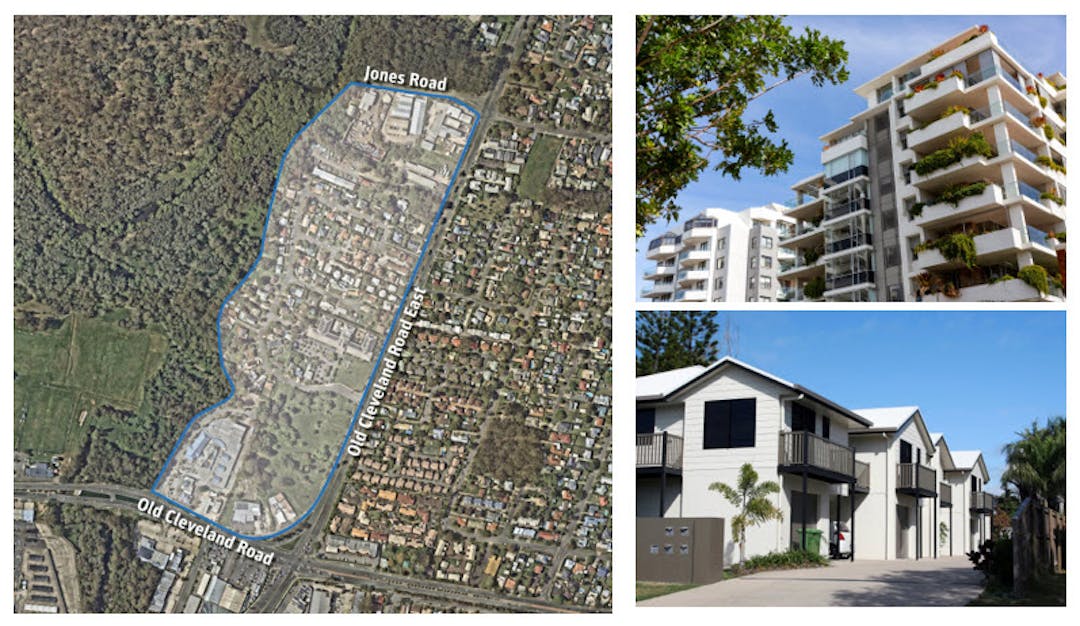
Redland City Council is developing a Local Area Plan (LAP) for the Jones Road to Old Cleveland Road area in Capalaba, and we need your input. This exciting initiative aims to shape the future of our growing city over the next 25 years and beyond.
The Jones Road to Old Cleveland Road LAP study area is ideally located near public transport, employment hubs, sporting fields, green spaces, and community facilities. It presents a perfect opportunity to create a thriving medium-density community while building upon and enhancing the existing neighbourhood.
To kickstart community discussions, we've developed two growth scenarios that illustrate potential development opportunities for the area. These scenarios were informed by several background studies, including a planning report (RCC), urban design framework (LatStudios), access and movement report (PSA consulting) and draft infrastructure capacity assessment (H2One). Each of these documents are available for download in the 'Key documents' section. The scenarios highlight how the precinct could evolve into a more vibrant and connected neighbourhood over time while maintaining its important features.
The LAP aims to revitalise this neighbourhood by:
- Adjusting zone boundaries and supporting increased building heights
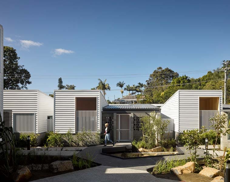
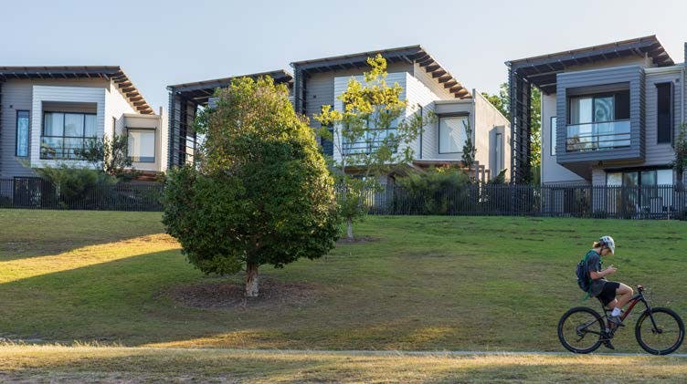
- Encouraging a mix of higher-density housing options
- Enhancing buffers between residential, industrial, and commercial areas
- Identifying key intersection upgrades to improve traffic flow
- Improving access to open spaces and delivering key pedestrian connections
- Protecting important ecological values, including local creek corridors
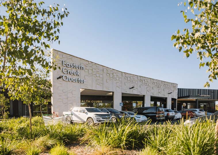
- Enhancing commercial areas to create more job opportunities
Your input is crucial in shaping the future of this area. We invite you to review the draft local area plan scenarios and share your thoughts on the proposed changes by completing the online survey. You can also book a meet-the-planner session to learn more about the project.
Don't miss this chance to influence the future of your community. Public consultation on potential Jones Road to Old Cleveland Road LAP scenarios closes on Friday 2 May 2025.
We value your input on the draft scenarios for the Jones Road to Old Cleveland Road Local Area Plan.
We invite you to please review the Jones Road to Old Cleveland Road (JROCR) Local Area Plan scenarios below, with background studies and explanatory material on this web page before completing the Survey to share your thoughts and have the chance to win a $50 Eftpos voucher [see Terms and Conditions].
The following scenarios are taken from the 'Jones Road to Old Cleveland Road - Local Area Plan Scenarios' document. This is available for download in the Key Documents section.
Scenario 1 - Medium Change Scenario
Key proposals:
- Retain the northern mixed-use zone adjoining Jones Road and the nominal 15m (approx. 5 storeys) maximum building height.
- Rezone low-density residential land on the western side of Brewer Street to medium-density residential. Adopt a nominal 15m (approx. 5 storeys) maximum building height.
- Retain the existing medium-density residential zoning in the centre of the study area and the nominal 13m maximum building height (approx. 4 storeys).
- Rezone Bunnings’ landholdings at 238-254 Old Cleveland Road East, creating a consolidated mixed-use zone that extends from Old Cleveland Road to Brewer Street.
- Provide for increased building heights (21m or approx. 7 storeys) at 194-200 Old Cleveland Road (the Golden Circle site).
- Provide for a major signalised upgrade at the Brewer Street/ Old Cleveland Road East intersection, including an east-west pedestrian connection.
- Complete missing pathway connections.
- Establish a 2.5m wide shared path linking along Brewer Street to the future Birkdale Community Precinct.
- Provide a single consolidated access from Brewer Street to the Bunnings site at 238-254 Old Cleveland Road East.
- Establish the missing active transport connection from the Anderson Street stub through to Brewer Street.
- Upgrade the bridge connection and improve active transport connectivity to the Sam Sciacca Sporting fields in the west.
- Provide for a buffer between the northern mixed-use zone and central medium-density residential zone.
- Establish a landscaping buffer along the northern and eastern frontages of the Bunnings site to improve visual amenity, screen parking areas and reduce the visual bulk/scale of future development.
- Facilitate the delivery of a gateway building on the Bunnings site that signifies precinct entry through architectural significance and visual impact.

Scenario 2 - High Change Scenario
Key proposals:
- Rezone the northern mixed-use zone to medium-density residential. Adopt a 21m (approx. 7 storeys) nominal maximum building height for this part of the study area.
- Rezone low-density residential land on the western side of Brewer Street to medium-density residential.
- Adopt a nominal 15m (approx. 5 storeys) maximum building height across the entirety of the central medium-density residential zone.
- Rezone the landholdings at 238-254 Old Cleveland Road East, creating a consolidated mixed-use zone that extends from Old Cleveland Road to Brewer Street. Increase nominal building heights in this area to 30m. Also provide for increased (21m or approx. 7 storeys) building heights at 194-200 Old Cleveland Road (the Golden Circle site).
- Provide for a major signalised upgrade at the Brewer Street/ Old Cleveland Road East intersection, including an east-west pedestrian connection.
- Complete missing pathway connections.
- Establish a 2.5m wide shared path linking along Brewer Street to the future Birkdale Community Precinct.
- Provide a single consolidated access from Brewer Street to the Bunnings site at 238-254 Old Cleveland Road East.
- Provide a new road and pathway connection linking Lyre Street to Jones Road.
- Via Anderson Street, provide for service vehicle access to the Bunnings site (Note: a through connection to Brewer Street that enables vehicle ‘rat-running’ is not supported).
- Establish the missing active transport connection from the Anderson Street stub through to Brewer Street.
- Upgrade the bridge connection and improve active transport connectivity to the Sam Sciacca Sporting fields in the west.
- Through redevelopment of key sites, facilitate the establishment of active frontages surrounding the southern mixed-use zone.
- Facilitate the establishment of additional ground floor retail tenancies along frontages to Old Cleveland Road and Old Cleveland Road East.
- Facilitate the delivery of a gateway building on the Bunnings site that signifies precinct entry through architectural significance and visual impact.

Custom

Key Documents
-
 Jones Road to Old Cleveland Road - Local Area Plan Scenarios (10.3 MB) (pdf)
-
Scenario 1 Map - Medium Change (high resolution) (16.3 MB) (pdf)
-
Scenario 2 Map - High Change (high resolution) (15.8 MB) (pdf)
-
Jones Road to Old Cleveland Road Local Area Plan - A3 Flyer (5.41 MB) (pdf)
-
Jones Road to Old Cleveland Road - Planning Report (4.76 MB) (pdf)
-
Jones Road to Old Cleveland Road - Urban Design Framework (17.7 MB) (pdf)
-
Jones Road to Old Cleveland Road - Access and Movement Report (12.1 MB) (pdf)
-
Jones Road to Old Cleveland Road - Infrastructure Capacity Assessment (Water and Sewer)_Draft (2.59 MB) (pdf)
-
Council General Meeting - 22 January 2025 - Report and Minutes (7.26 MB) (pdf)