Shoreline
Consultation has concluded
About Shoreline
A Preliminary Approval under section 242 of the Sustainable Planning Act 2009 (SPA) for a material change of use to vary the effect of the Redlands Planning Scheme (RPS) for a master planned urban community, including town centre, town centre frame, residential and open space precincts was approved by Redland City Council on 18 November 2015 (ref: MCU13287). For details of the application visit our meeting minutes and agenda page.
Version 1 of the RPS adopted in March 2006 zoned 310ha of the land to the south of Redland Bay as Investigation zone. The South East Queensland (SEQ) Regional Plan 2005 was also adopted around this time and identified the land as being within the Southern Redland Bay Investigation Area. Both investigation designations stipulated that further work would be required to assess the potential impacts of development, the infrastructure requirements and the most appropriate use and layout of the land. These studies were completed by the applicant and assessed by Council and the State government as part of the Shoreline development application.
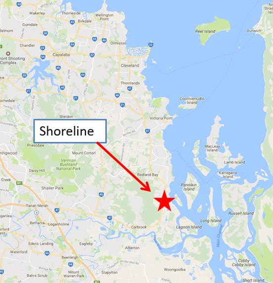
Shoreline – Location within southern Redland Bay
Shoreline Approved Master Plan
Shoreline Plan of Development
The Shoreline Plan of Development (POD) is a component of the Preliminary Approval which varies the effect of the local planning scheme for the premises. It establishes the framework under which future development applications relating to the subject land will be assessed. The Shoreline POD contains varied and additional assessment benchmarks and provisions to those set out within the planning scheme. Where there is any inconsistency between the planning scheme and the Shoreline POD, the Shoreline POD prevails.
The Preliminary Approval (Variation Approval), including the Shoreline POD, remains in effect until the development is completed or the Preliminary Approval lapses.
Infrastructure Agreement
An Infrastructure Agreement is a written agreement between a developer and a public sector entity about the supply or funding of infrastructure and establishes the obligations of each party and a schedule of works. It is a key component of the approval and ensures that the necessary infrastructure to service this new development is paid for and provided by this development at no cost to the broader community.
The developer is required to provide the following infrastructure to service the development in accordance with the current Infrastructure Agreement:
Wastewater and Water
Design and construct a reticulated sewer and water system to service the entire development site and maintain and operate these assets for a minimum of 5 years.
Pay a financial contribution in accordance with Councils Infrastructure Charges Resolution towards water supply infrastructure.
Transport
Design and construct a signalised intersection at Heinemann Road/Double Jump Road.
Construct an extensive cycleway network throughout the development with a connection through to Redland Bay and maintain these assets for a minimum of 5 years.
Pay a financial contribution in accordance with Council’s Infrastructure Charges Resolution towards local road and cycleway infrastructure.
Stormwater
Design and construct all stormwater infrastructure to service the development, dedicate the land on which the stormwater infrastructure is located and maintain these assets for a minimum of 5 years.
Recreation and Community Facilities
Provide land and embellishments for a destination and community recreation park (along the foreshore), two district sports parks and local neighbourhood parks throughout the site.
Provide a new community facility and maintain this facility for a minimum of 5 years.
Pay a financial contribution in accordance with Councils Infrastructure Charges Resolution towards the infrastructure network.
Marine facilities
Pay a financial contribution towards the delivery of a new boat ramp within southern Redland Bay.
Provide two kayak launch points within the development or a financial contribution in lieu.
Conservation/Open space land
Dedicate significant amounts of land for open space and conservation purposes, including the provision of an extensive foreshore park.
Southern Redland Bay expansion area
During the public consultation period for the State Government's Shaping Queensland - South East Queensland Regional Plan 2017, submissions were received regarding land adjacent to the then urban footprint at Southern Redland Bay. In considering submissions, the State recognised that this area represented a logical extension to the urban footprint, and included areas of suitable land, and would benefit from existing and planning infrastructure committed to support the Southern Redland Bay area. The State government's regional plan took effect from August 2017 with the amendments to the urban footprint.
Southern Redland Bay area with pre-2017 urban footprint
Southern Redland Bay area with updated urban footprint
Current applications in the expansion area include:
MCU21/0033: An application for a preliminary approval (variation request) for a relocatable home park and associated uses; and for a development permit for reconfiguring a lot (4 into 4 lots), was lodged with Council on 23/02/2021. Details for this application and its current status in the assessment and public notification process are available on Council's Development.i.
MCU21/0065: An application for a preliminary approval (variation request) for a material change of use and reconfiguring a lot; and for a development permit for reconfiguring a lot (2 into 38 residential lots, 3 balance lots, new road, open space, park and drainage), was lodged with Council on 16/04/2021. Details for this application and its current status in the assessment and public notification process are available on Council's Development.i.
MCU22/0033: An application for a preliminary approval(variation request) for a material change of use was lodged with Council on 28/01/2022. Details for this application and its current status in the assessment and public notification process are available on Council's Development.i.
Bayhill Estate
This 17.45ha parcel of land at 48-66 Scenic Road, Redland Bay, is not part of the Shoreline approval, however the site adjoins Shoreline and benefits from the utility infrastructure networks that will be constructed to service Shoreline. A development application for a preliminary approval (variation request) for a material change of use for master planned urban community comprising town centre frame, residential and open space precincts was approved by Council on 16/03/2022. The precincts have been designed to align with the Shoreline precincts. Details for this approval are available on Council's Development.i.
Approved Bayhill Precinct Plan
Southern Redland Bay Wastewater Treatment Plan and Wetlands project
The infrastructure agreement for the Shoreline development requires the developer, Lendlease Communities Pty Ltd, to construct a reticulated sewer system to service this development, including providing a treatment plant for the expected 10,000 new residents within the Shoreline development project. With the regional plan identifying a broader development in Southern Redland Bay, Council resolved in August 2019 that the future wastewater treatment plant would be built to service this broader area, equating to a total population of 13,500 equivalent persons (EP) being serviced by this new treatment plant.
A wastewater treatment plant represents a large and long-term investment in infrastructure and planning for this broader catchment and makes financial sense, rather than planning only for the Shoreline development and having to retrofit a solution for the broader area at a later stage. The treatment plant will be delivered in stages to service new populations as they arrive and is planned to be delivered by Lendlease as part of their infrastructure agreement obligations. While Lendlease are only required to build a plant servicing the Shoreline development, they plan to deliver the entire treatment plant (in stages), with this infrastructure paid for by Lendlease and the proponents of future development in the broader area.
The wastewater treatment plant will be located on a large parcel of land within Redland City near the Logan River. Lendlease Communities (Shoreline) Pty Ltd, as the proponent, subsequently applied to the State for a ministerial infrastructure designation (MID) that was approved by the Minister on 24 June 2021. The infrastructure will be designed and constructed by Lendlease, but owned and operated by Redland City Council. It is approved to be a membrane bioreactor plant, which will treat effluent to meet strict water quality guidelines. It additionally includes a new mangrove and salt marsh habitat area along the Logan River to further filter water. Further information can be found on the Department of State Development, Mining, Infrastructure and Planning website at: https://planning.statedevelopment.qld.gov.au/planning-framework/infrastructure-planning/infrastructure-designations

Federal approval for matters of national environmental significance under the Environment Protection and Biodiversity Act 1999 was given on 13/10/2021. Information on this matter can be found on the website of the Department of Agriculture, Water and the Environment under reference number 2020/8849: http://epbcnotices.environment.gov.au/publicnoticesreferrals/