Coastal Hazard Adaptation Strategy
Consultation has concluded
Planning for the future of Redlands Coast.
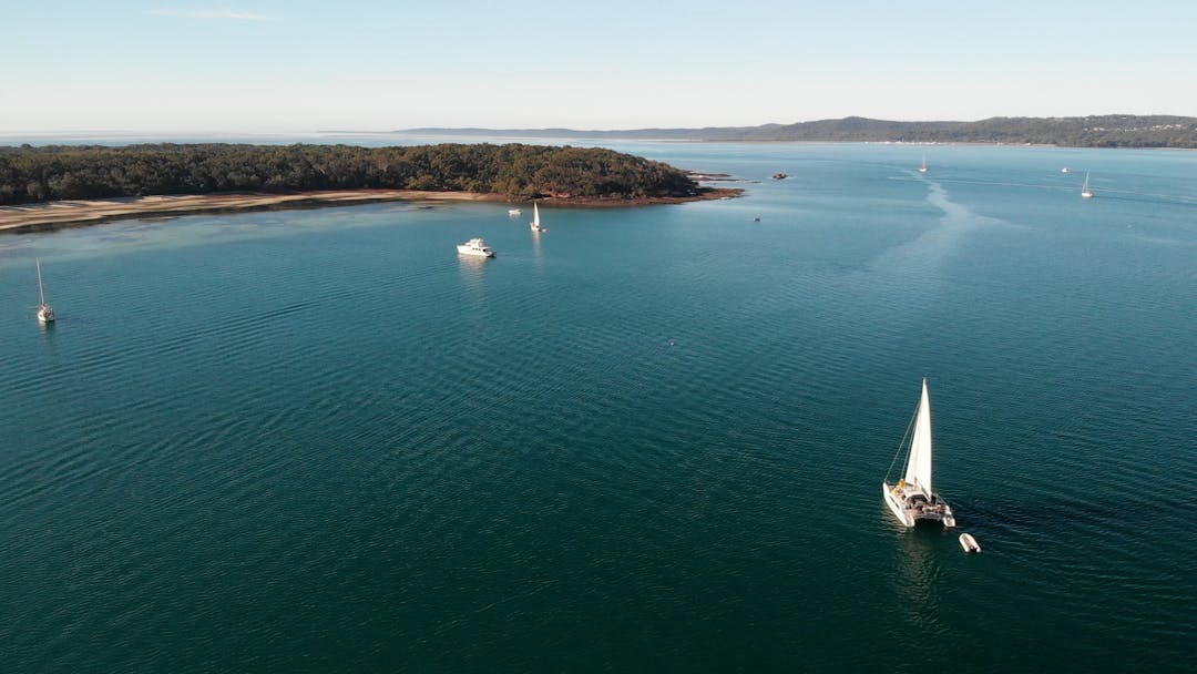
Redland City is blessed with 335 kilometres of coastline and foreshore areas, from Tingalpa Creek at Thorneside south to the mouth of the Logan River and across the Southern Moreton Bay Islands and North Stradbroke Island (Minjerribah). It has a rich and long history and is the traditional and spiritual home of the Quandamooka People.
The coastal zone has significant ecological value and includes Ramsar listed sites and parts of the Moreton Bay Marine Park. Moreton Bay (Quandamooka) provides a habitat for a diverse range of unique plants, and animals including rare, vulnerable, and endangered species such as migratory shorebirds, frogs, dugongs, and turtles.
The coastal environment also holds significant recreational, commercial, and eco-cultural tourism value. The region is renowned for scuba diving, boating, and recreational and commercial fishing. These values have seen Redlands Coast become a popular place for us to live and work and is home to more than 160,000 residents, many of who live adjacent to or within proximity to the coastline.
Redlands Coast experiences regular impacts associated with storm events resulting in erosion and tidal inundation of low-lying areas.
Council is being proactive and developing a long-term comprehensive plan known as the Coastal Hazard Adaptation Strategy to:
- identify coastal hazard areas
- understand vulnerabilities and risks to a range of assets and values
- engage with the community to understand their preferred approach to adaptation
- determine the costs, priorities, and timeframes for their implementation.
Find out more and get involved
- Download Council's Coastal Hazard Adaptation Strategy by clicking here
- Read the project fact sheets
- Register to receive future updates
- Click on a yellow pin on the erosion map below to find out what Council knows about erosion at each site
- Share your knowledge of an area at risk by dragging and dropping a red pin and/or uploading your photos and comments
- Explore Council’s Red-E-Maps to find your property and any related overlays, or browse the overlay maps on the Redland City Plan site
Planning for the future of Redlands Coast.
Redland City is blessed with 335 kilometres of coastline and foreshore areas, from Tingalpa Creek at Thorneside south to the mouth of the Logan River and across the Southern Moreton Bay Islands and North Stradbroke Island (Minjerribah). It has a rich and long history and is the traditional and spiritual home of the Quandamooka People.
The coastal zone has significant ecological value and includes Ramsar listed sites and parts of the Moreton Bay Marine Park. Moreton Bay (Quandamooka) provides a habitat for a diverse range of unique plants, and animals including rare, vulnerable, and endangered species such as migratory shorebirds, frogs, dugongs, and turtles.
The coastal environment also holds significant recreational, commercial, and eco-cultural tourism value. The region is renowned for scuba diving, boating, and recreational and commercial fishing. These values have seen Redlands Coast become a popular place for us to live and work and is home to more than 160,000 residents, many of who live adjacent to or within proximity to the coastline.
Redlands Coast experiences regular impacts associated with storm events resulting in erosion and tidal inundation of low-lying areas.
Council is being proactive and developing a long-term comprehensive plan known as the Coastal Hazard Adaptation Strategy to:
- identify coastal hazard areas
- understand vulnerabilities and risks to a range of assets and values
- engage with the community to understand their preferred approach to adaptation
- determine the costs, priorities, and timeframes for their implementation.
Find out more and get involved
- Download Council's Coastal Hazard Adaptation Strategy by clicking here
- Read the project fact sheets
- Register to receive future updates
- Click on a yellow pin on the erosion map below to find out what Council knows about erosion at each site
- Share your knowledge of an area at risk by dragging and dropping a red pin and/or uploading your photos and comments
- Explore Council’s Red-E-Maps to find your property and any related overlays, or browse the overlay maps on the Redland City Plan site
-
Share I cannot see anything in the Redland Bay section of the draft strategy (pages 34 and 35) about the long term erosion at Sandy Cove Place beach and foreshore. It is identified in the Red-E Maps by red pin and comments that I made some time ago but there is no reference to this area in the Table 15. Redland Bay adaptation pathway on page 35. I have been discussing this area with council officers over the last 8 years. Has Council assessed the coastal erosion at Sandy Cove Beach using Council's adopted Coastal Adaptation Strategy Phase 1 - Current Hazards (CAS) framework? If so what level of risk has the erosion hazard has been identified as and what responses are planned? Will the following responses apply? Monitor and record erosion through annual site survey; and Initiate planning, construction, and design of a permanent foreshore protection structure within five years, dependent on Council’s annual budget process. Finally how do I add photos to the red pin information? Thank you. James. on Facebook Share I cannot see anything in the Redland Bay section of the draft strategy (pages 34 and 35) about the long term erosion at Sandy Cove Place beach and foreshore. It is identified in the Red-E Maps by red pin and comments that I made some time ago but there is no reference to this area in the Table 15. Redland Bay adaptation pathway on page 35. I have been discussing this area with council officers over the last 8 years. Has Council assessed the coastal erosion at Sandy Cove Beach using Council's adopted Coastal Adaptation Strategy Phase 1 - Current Hazards (CAS) framework? If so what level of risk has the erosion hazard has been identified as and what responses are planned? Will the following responses apply? Monitor and record erosion through annual site survey; and Initiate planning, construction, and design of a permanent foreshore protection structure within five years, dependent on Council’s annual budget process. Finally how do I add photos to the red pin information? Thank you. James. on X (formerly Twitter) Share I cannot see anything in the Redland Bay section of the draft strategy (pages 34 and 35) about the long term erosion at Sandy Cove Place beach and foreshore. It is identified in the Red-E Maps by red pin and comments that I made some time ago but there is no reference to this area in the Table 15. Redland Bay adaptation pathway on page 35. I have been discussing this area with council officers over the last 8 years. Has Council assessed the coastal erosion at Sandy Cove Beach using Council's adopted Coastal Adaptation Strategy Phase 1 - Current Hazards (CAS) framework? If so what level of risk has the erosion hazard has been identified as and what responses are planned? Will the following responses apply? Monitor and record erosion through annual site survey; and Initiate planning, construction, and design of a permanent foreshore protection structure within five years, dependent on Council’s annual budget process. Finally how do I add photos to the red pin information? Thank you. James. on Linkedin Email I cannot see anything in the Redland Bay section of the draft strategy (pages 34 and 35) about the long term erosion at Sandy Cove Place beach and foreshore. It is identified in the Red-E Maps by red pin and comments that I made some time ago but there is no reference to this area in the Table 15. Redland Bay adaptation pathway on page 35. I have been discussing this area with council officers over the last 8 years. Has Council assessed the coastal erosion at Sandy Cove Beach using Council's adopted Coastal Adaptation Strategy Phase 1 - Current Hazards (CAS) framework? If so what level of risk has the erosion hazard has been identified as and what responses are planned? Will the following responses apply? Monitor and record erosion through annual site survey; and Initiate planning, construction, and design of a permanent foreshore protection structure within five years, dependent on Council’s annual budget process. Finally how do I add photos to the red pin information? Thank you. James. link
I cannot see anything in the Redland Bay section of the draft strategy (pages 34 and 35) about the long term erosion at Sandy Cove Place beach and foreshore. It is identified in the Red-E Maps by red pin and comments that I made some time ago but there is no reference to this area in the Table 15. Redland Bay adaptation pathway on page 35. I have been discussing this area with council officers over the last 8 years. Has Council assessed the coastal erosion at Sandy Cove Beach using Council's adopted Coastal Adaptation Strategy Phase 1 - Current Hazards (CAS) framework? If so what level of risk has the erosion hazard has been identified as and what responses are planned? Will the following responses apply? Monitor and record erosion through annual site survey; and Initiate planning, construction, and design of a permanent foreshore protection structure within five years, dependent on Council’s annual budget process. Finally how do I add photos to the red pin information? Thank you. James.
yacht asked over 5 years agoHi yacht,
Sandy Cove Place Beach is not specifically mentioned in the draft CHAS as the strategy focuses on establishing the adaptation pathways of larger localities rather than specific sites.
In June 2019, Council assessed the coastal erosion at Sandy Cove Place Beach using Council's adopted Coastal Adaptation Strategy Phase 1 - Current Hazards (CAS) framework. The erosion hazard has been identified as low risk and, based on this assessment, the following response is planned:
- Monitor and record erosion through annual site surveys
The foreshore at Sandy Cove Place Beach is among several erosion sites that Council monitors on a routine basis. The next planned site inspection is scheduled for early-2021.
To download the CAS document, please click here. The document is also available on the CHAS project page.
To add photos to a pin, simply drag a red or yellow pin to the appropriate location on the map. In this case, you will not be able to edit a previously dropped pin, so you will have to add a new pin to the location. Once the pin is dropped, a sidebar will appear on the left-hand side and the 'Add photos' button will allow you to attach images to your pin.
Should you have any further questions, please contact Redland City Council on 07 3829 8999.
Kind regards,
CHAS Project Team
-
Share The statement in the Draft Coastal Hazard Adaptation Strategy at Section 1.1 is incorrect. It states, "The Traditional Owners are the Quandamooka People who have cared for the land and sea of this ancient landscape for thousands of years. The Quandamooka Yoolooburrabee Aboriginal Corporation (QYAC) has recognised Native Title rights under the Native Title Act 1993." The Quandamooka may claim all of the lands within Redland City, but not all of that land has been ceded to the Quandamooka under the Native Title Act 1993. Only Moreton and North Stradbroke Islands, including some of the seas adjacent to those Islands, have been ceded to date. In any case, the Quandamooka people are composed of three distinct tribes, the Nunukul, the Goenpul and the Ngugi, and they live primarily on Moreton and North Stradbroke Islands. They do not represent the different 'tribes' who occupied the mainland. on Facebook Share The statement in the Draft Coastal Hazard Adaptation Strategy at Section 1.1 is incorrect. It states, "The Traditional Owners are the Quandamooka People who have cared for the land and sea of this ancient landscape for thousands of years. The Quandamooka Yoolooburrabee Aboriginal Corporation (QYAC) has recognised Native Title rights under the Native Title Act 1993." The Quandamooka may claim all of the lands within Redland City, but not all of that land has been ceded to the Quandamooka under the Native Title Act 1993. Only Moreton and North Stradbroke Islands, including some of the seas adjacent to those Islands, have been ceded to date. In any case, the Quandamooka people are composed of three distinct tribes, the Nunukul, the Goenpul and the Ngugi, and they live primarily on Moreton and North Stradbroke Islands. They do not represent the different 'tribes' who occupied the mainland. on X (formerly Twitter) Share The statement in the Draft Coastal Hazard Adaptation Strategy at Section 1.1 is incorrect. It states, "The Traditional Owners are the Quandamooka People who have cared for the land and sea of this ancient landscape for thousands of years. The Quandamooka Yoolooburrabee Aboriginal Corporation (QYAC) has recognised Native Title rights under the Native Title Act 1993." The Quandamooka may claim all of the lands within Redland City, but not all of that land has been ceded to the Quandamooka under the Native Title Act 1993. Only Moreton and North Stradbroke Islands, including some of the seas adjacent to those Islands, have been ceded to date. In any case, the Quandamooka people are composed of three distinct tribes, the Nunukul, the Goenpul and the Ngugi, and they live primarily on Moreton and North Stradbroke Islands. They do not represent the different 'tribes' who occupied the mainland. on Linkedin Email The statement in the Draft Coastal Hazard Adaptation Strategy at Section 1.1 is incorrect. It states, "The Traditional Owners are the Quandamooka People who have cared for the land and sea of this ancient landscape for thousands of years. The Quandamooka Yoolooburrabee Aboriginal Corporation (QYAC) has recognised Native Title rights under the Native Title Act 1993." The Quandamooka may claim all of the lands within Redland City, but not all of that land has been ceded to the Quandamooka under the Native Title Act 1993. Only Moreton and North Stradbroke Islands, including some of the seas adjacent to those Islands, have been ceded to date. In any case, the Quandamooka people are composed of three distinct tribes, the Nunukul, the Goenpul and the Ngugi, and they live primarily on Moreton and North Stradbroke Islands. They do not represent the different 'tribes' who occupied the mainland. link
The statement in the Draft Coastal Hazard Adaptation Strategy at Section 1.1 is incorrect. It states, "The Traditional Owners are the Quandamooka People who have cared for the land and sea of this ancient landscape for thousands of years. The Quandamooka Yoolooburrabee Aboriginal Corporation (QYAC) has recognised Native Title rights under the Native Title Act 1993." The Quandamooka may claim all of the lands within Redland City, but not all of that land has been ceded to the Quandamooka under the Native Title Act 1993. Only Moreton and North Stradbroke Islands, including some of the seas adjacent to those Islands, have been ceded to date. In any case, the Quandamooka people are composed of three distinct tribes, the Nunukul, the Goenpul and the Ngugi, and they live primarily on Moreton and North Stradbroke Islands. They do not represent the different 'tribes' who occupied the mainland.
Lindsay Hackett asked over 5 years agoHi Lindsay,
Thank you for your feedback.
Section 1.1 of the CHAS is not intended to imply that a native title determination has been made over the entire area of Redland City. A native title determination has been made recognising the native title rights of the Quandamooka People over North Stradbroke Island and surrounding waters. Another claim has also been registered by the Quandamooka People over parts of the mainland and surrounding waters. A determination on this claim is yet to be made by the Court.
Council acknowledges there are other tribes who occupied other parts of the mainland within Redland City. The Quandamooka People are the traditional owners of the lands and seas of Quandamooka Country, which includes Moreton Island, Stradbroke Island, the Southern Moreton Bay Islands, and parts of the mainland coast.
Kind regards,
CHAS Project Team
-
Share Is there any plan to protect the Sandy Beach part of the Boulevard on Russell Island. Every high tide that is combined with strong SE winds a little more of the bank is eaten away. I have been on the island for 10 years and in that time the bank has receded about a metre a year. The large tree stump there was inland of the beach when I first arrived. on Facebook Share Is there any plan to protect the Sandy Beach part of the Boulevard on Russell Island. Every high tide that is combined with strong SE winds a little more of the bank is eaten away. I have been on the island for 10 years and in that time the bank has receded about a metre a year. The large tree stump there was inland of the beach when I first arrived. on X (formerly Twitter) Share Is there any plan to protect the Sandy Beach part of the Boulevard on Russell Island. Every high tide that is combined with strong SE winds a little more of the bank is eaten away. I have been on the island for 10 years and in that time the bank has receded about a metre a year. The large tree stump there was inland of the beach when I first arrived. on Linkedin Email Is there any plan to protect the Sandy Beach part of the Boulevard on Russell Island. Every high tide that is combined with strong SE winds a little more of the bank is eaten away. I have been on the island for 10 years and in that time the bank has receded about a metre a year. The large tree stump there was inland of the beach when I first arrived. link
Is there any plan to protect the Sandy Beach part of the Boulevard on Russell Island. Every high tide that is combined with strong SE winds a little more of the bank is eaten away. I have been on the island for 10 years and in that time the bank has receded about a metre a year. The large tree stump there was inland of the beach when I first arrived.
Peter Shute asked over 5 years agoHi Peter,
Thank you for your enquiry regarding the current foreshore erosion at Sandy Beach, Russell Island.
In June 2019, Council assessed the coastal erosion at Sandy Beach using Council's adopted Coastal Adaptation Strategy Phase 1 - Current Hazards (CAS) framework. The erosion hazard has been identified as medium risk and, based on this assessment, the following responses are planned:
- Monitor and record erosion through annual site survey; and
- Initiate planning, construction, and design of a permanent foreshore protection structure within five years, dependent on Council’s annual budget process.
The foreshore at Sandy Beach is among approximately 35 high and medium-hazard erosion sites that Council monitors on a routine basis.
To download the CAS document, please click here. The document is also available on the CHAS project page.
Should you have any further questions, please contact Redland City Council on 07 3829 8999.
Kind regards,
CHAS Project Team
-
Share OK, but the strategy refers to the other reports if you want more information... if we're unable to review these, maybe you should take those references out..? Also I'd be interested in the risk to my property at the local level, are the risk maps going to be made available? on Facebook Share OK, but the strategy refers to the other reports if you want more information... if we're unable to review these, maybe you should take those references out..? Also I'd be interested in the risk to my property at the local level, are the risk maps going to be made available? on X (formerly Twitter) Share OK, but the strategy refers to the other reports if you want more information... if we're unable to review these, maybe you should take those references out..? Also I'd be interested in the risk to my property at the local level, are the risk maps going to be made available? on Linkedin Email OK, but the strategy refers to the other reports if you want more information... if we're unable to review these, maybe you should take those references out..? Also I'd be interested in the risk to my property at the local level, are the risk maps going to be made available? link
OK, but the strategy refers to the other reports if you want more information... if we're unable to review these, maybe you should take those references out..? Also I'd be interested in the risk to my property at the local level, are the risk maps going to be made available?
Haley asked over 5 years agoHi Haley,
The draft strategy references data and other information developed during previous phases to indicate the source of the data.
Please be advised detailed information and mapping of erosion-prone areas and storm tide inundation extents are available in the Redland City Plan.
For interactive mapping, please click here ‘Red-E-Maps’ or for the PDF documents, please visit the Redland City Plan page here. The overlay maps are available for both coastal protection (erosion-prone areas) and flood and storm tide hazards.
These links are also available on the CHAS Your Say page under the heading Find Out More and Get Involved.
We hope this information can assist you.
Kind regards,
CHAS Project Team
-
Share Are the other phase reports available for reading? on Facebook Share Are the other phase reports available for reading? on X (formerly Twitter) Share Are the other phase reports available for reading? on Linkedin Email Are the other phase reports available for reading? link
Are the other phase reports available for reading?
Haley asked over 5 years agoHi Haley,
The individual phase reports are technical inputs, rather than Council policies.
Please be advised that the draft Coastal Hazard Adaptation Strategy summarises the findings of each of the reports and presents the proposed strategy.
Kind regards,
CHAS Project Team
-
Share Why are we doing this when cyclone activity is neither accelerating nor increasing? According to the observed data from BOM, cyclone activity is decreasing. Source: http://www.bom.gov.au/cyclone/climatology/trends.shtml on Facebook Share Why are we doing this when cyclone activity is neither accelerating nor increasing? According to the observed data from BOM, cyclone activity is decreasing. Source: http://www.bom.gov.au/cyclone/climatology/trends.shtml on X (formerly Twitter) Share Why are we doing this when cyclone activity is neither accelerating nor increasing? According to the observed data from BOM, cyclone activity is decreasing. Source: http://www.bom.gov.au/cyclone/climatology/trends.shtml on Linkedin Email Why are we doing this when cyclone activity is neither accelerating nor increasing? According to the observed data from BOM, cyclone activity is decreasing. Source: http://www.bom.gov.au/cyclone/climatology/trends.shtml link
Why are we doing this when cyclone activity is neither accelerating nor increasing? According to the observed data from BOM, cyclone activity is decreasing. Source: http://www.bom.gov.au/cyclone/climatology/trends.shtml
LuvRedands asked about 6 years agoHi LuvRedands,
The Coastal Hazard Adaptation Strategy is not just looking at cyclone activity. It is looking at the broad range of coastal hazards that impact the coastline, both currently and into the future. This includes storm tide inundation, coastal erosion, and sea level rise.
Kind regards,
CHAS Project Team
-
Share Why are we preparing for an 80 Cm rise in sea level when the archived Brisbane Bar data records show there has only been an - at most - 2.5 Cm rise in the last 35 years - most of which happened over a decade ago? How can a 2.5Cm rise over 35 years suddenly become an up to 80 Cm rise in the next 80 years? There is no currently observed Rising - and therefore certainly no accelerating - trend. Source: https://www.data.qld.gov.au/dataset/brisbane-bar-tide-gauge-archived-interval-recordings on Facebook Share Why are we preparing for an 80 Cm rise in sea level when the archived Brisbane Bar data records show there has only been an - at most - 2.5 Cm rise in the last 35 years - most of which happened over a decade ago? How can a 2.5Cm rise over 35 years suddenly become an up to 80 Cm rise in the next 80 years? There is no currently observed Rising - and therefore certainly no accelerating - trend. Source: https://www.data.qld.gov.au/dataset/brisbane-bar-tide-gauge-archived-interval-recordings on X (formerly Twitter) Share Why are we preparing for an 80 Cm rise in sea level when the archived Brisbane Bar data records show there has only been an - at most - 2.5 Cm rise in the last 35 years - most of which happened over a decade ago? How can a 2.5Cm rise over 35 years suddenly become an up to 80 Cm rise in the next 80 years? There is no currently observed Rising - and therefore certainly no accelerating - trend. Source: https://www.data.qld.gov.au/dataset/brisbane-bar-tide-gauge-archived-interval-recordings on Linkedin Email Why are we preparing for an 80 Cm rise in sea level when the archived Brisbane Bar data records show there has only been an - at most - 2.5 Cm rise in the last 35 years - most of which happened over a decade ago? How can a 2.5Cm rise over 35 years suddenly become an up to 80 Cm rise in the next 80 years? There is no currently observed Rising - and therefore certainly no accelerating - trend. Source: https://www.data.qld.gov.au/dataset/brisbane-bar-tide-gauge-archived-interval-recordings link
Why are we preparing for an 80 Cm rise in sea level when the archived Brisbane Bar data records show there has only been an - at most - 2.5 Cm rise in the last 35 years - most of which happened over a decade ago? How can a 2.5Cm rise over 35 years suddenly become an up to 80 Cm rise in the next 80 years? There is no currently observed Rising - and therefore certainly no accelerating - trend. Source: https://www.data.qld.gov.au/dataset/brisbane-bar-tide-gauge-archived-interval-recordings
LuvRedands asked about 6 years agoHi LuvRedands,
The Coastal Hazard Adaptation Strategy follows the sea level rise parameters adopted by the Queensland State Government and outlined in the Queensland Coastal Plan and Coastal Hazard Technical Guide. This is a requirement of the Minimum Standards and Guide for the QCoast program.
The Queensland State Government's website (https://www.qld.gov.au/environment/coasts-waterways/plans/hazards/sea-level-mapping) explains that ‘The projected sea-level rise of 0.8 metres by the year 2100 adopted by the Queensland State Government is based on climate modelling for probable scenarios of world development presented in the Intergovernmental Panel on Climate Change (IPCC) Fifth Assessment Report.'
Kind regards,
CHAS Project Team
-
Share Who exactly are the members of the CHAS steering committee meeting? on Facebook Share Who exactly are the members of the CHAS steering committee meeting? on X (formerly Twitter) Share Who exactly are the members of the CHAS steering committee meeting? on Linkedin Email Who exactly are the members of the CHAS steering committee meeting? link
Who exactly are the members of the CHAS steering committee meeting?
Chris asked about 6 years agoHi Chris,
The CHAS Steering Committee is chaired by Mayor Karen Williams and comprises of the following:
- Senior Queensland State Government representatives from the Department of Environment and Science, Department of National Parks, Sport and Racing, Department of Natural Resources, Mines and Energy, Department of Agriculture, Fisheries and Forestry and Department of State Development Infrastructure and Planning
- A representative from Quandamooka Yoolooburrabee Aboriginal Corporation
- A representative from Healthy Land and Water
- A researcher from the Queensland University of Technology who specialises in regional and urban planning
- An independent shoreline expert nominated by the National Committee for Coastal and Ocean Engineers
- Two Council Group Managers from the engineering and environmental assessment planning teams
- Two Council officers from the Communication, Engagement and Tourism team
Kind regards,
CHAS Project Team
-
Share hello I spoken to a Gerard Noon on the weekend just gone at Bailey road park reserve Have the council read the Moreton Bay Study Published in 1999 its a scientific basis for the Healthy waterway campaign( William C. Dennison & Eva G. Abal ) the Book is avery good read get better understanding what's going on with the bay its good are trying to protect the Redlands city council coast line example in waterloo bay is shoreline between Manly / Lota/ Thorneside Wellington point plus Aquatic Paradise well waterloo bay has Water Turbidity where light struggles to penetrate sea floor means no life for seafloor to be sustainable means that sea grass doesn't grow in turn doesn't put roots down to help keep sea bed stable along the shore coast line also don't have link where can really have you say only the paper card handed out on Facebook Share hello I spoken to a Gerard Noon on the weekend just gone at Bailey road park reserve Have the council read the Moreton Bay Study Published in 1999 its a scientific basis for the Healthy waterway campaign( William C. Dennison & Eva G. Abal ) the Book is avery good read get better understanding what's going on with the bay its good are trying to protect the Redlands city council coast line example in waterloo bay is shoreline between Manly / Lota/ Thorneside Wellington point plus Aquatic Paradise well waterloo bay has Water Turbidity where light struggles to penetrate sea floor means no life for seafloor to be sustainable means that sea grass doesn't grow in turn doesn't put roots down to help keep sea bed stable along the shore coast line also don't have link where can really have you say only the paper card handed out on X (formerly Twitter) Share hello I spoken to a Gerard Noon on the weekend just gone at Bailey road park reserve Have the council read the Moreton Bay Study Published in 1999 its a scientific basis for the Healthy waterway campaign( William C. Dennison & Eva G. Abal ) the Book is avery good read get better understanding what's going on with the bay its good are trying to protect the Redlands city council coast line example in waterloo bay is shoreline between Manly / Lota/ Thorneside Wellington point plus Aquatic Paradise well waterloo bay has Water Turbidity where light struggles to penetrate sea floor means no life for seafloor to be sustainable means that sea grass doesn't grow in turn doesn't put roots down to help keep sea bed stable along the shore coast line also don't have link where can really have you say only the paper card handed out on Linkedin Email hello I spoken to a Gerard Noon on the weekend just gone at Bailey road park reserve Have the council read the Moreton Bay Study Published in 1999 its a scientific basis for the Healthy waterway campaign( William C. Dennison & Eva G. Abal ) the Book is avery good read get better understanding what's going on with the bay its good are trying to protect the Redlands city council coast line example in waterloo bay is shoreline between Manly / Lota/ Thorneside Wellington point plus Aquatic Paradise well waterloo bay has Water Turbidity where light struggles to penetrate sea floor means no life for seafloor to be sustainable means that sea grass doesn't grow in turn doesn't put roots down to help keep sea bed stable along the shore coast line also don't have link where can really have you say only the paper card handed out link
hello I spoken to a Gerard Noon on the weekend just gone at Bailey road park reserve Have the council read the Moreton Bay Study Published in 1999 its a scientific basis for the Healthy waterway campaign( William C. Dennison & Eva G. Abal ) the Book is avery good read get better understanding what's going on with the bay its good are trying to protect the Redlands city council coast line example in waterloo bay is shoreline between Manly / Lota/ Thorneside Wellington point plus Aquatic Paradise well waterloo bay has Water Turbidity where light struggles to penetrate sea floor means no life for seafloor to be sustainable means that sea grass doesn't grow in turn doesn't put roots down to help keep sea bed stable along the shore coast line also don't have link where can really have you say only the paper card handed out
Mitch 67 asked about 9 years agoThank you for the information Mitch 67. One of the first actions of the Coastal Adaptation Strategy is to collate all available studies, reports and data to understand where knowledge gaps exist. The Moreton Bay Study 1999 has been included in this gap assessment process. Tim
-
Share Hello, I am a university student who is currently enrolled in a Public Involvement and Community Development Studio at Griffith University. For our final assessment we are required to attend a community involvement event. As such my partner and I were hoping to attend your Costal Adaptation event on May 4th at the Redland Bay Hotel. We guarantee our attendance will not be disruptive as it is a task in observing real life public engagement events. We will be courteous, quiet and will not hinder the proceedings. We would appreciate the opportunity to speak to the event runners if they are available before or after the event. Please contact us at anytime if you have any queries. Thank you for your time. Laura Gonchee and Brayden Mason on Facebook Share Hello, I am a university student who is currently enrolled in a Public Involvement and Community Development Studio at Griffith University. For our final assessment we are required to attend a community involvement event. As such my partner and I were hoping to attend your Costal Adaptation event on May 4th at the Redland Bay Hotel. We guarantee our attendance will not be disruptive as it is a task in observing real life public engagement events. We will be courteous, quiet and will not hinder the proceedings. We would appreciate the opportunity to speak to the event runners if they are available before or after the event. Please contact us at anytime if you have any queries. Thank you for your time. Laura Gonchee and Brayden Mason on X (formerly Twitter) Share Hello, I am a university student who is currently enrolled in a Public Involvement and Community Development Studio at Griffith University. For our final assessment we are required to attend a community involvement event. As such my partner and I were hoping to attend your Costal Adaptation event on May 4th at the Redland Bay Hotel. We guarantee our attendance will not be disruptive as it is a task in observing real life public engagement events. We will be courteous, quiet and will not hinder the proceedings. We would appreciate the opportunity to speak to the event runners if they are available before or after the event. Please contact us at anytime if you have any queries. Thank you for your time. Laura Gonchee and Brayden Mason on Linkedin Email Hello, I am a university student who is currently enrolled in a Public Involvement and Community Development Studio at Griffith University. For our final assessment we are required to attend a community involvement event. As such my partner and I were hoping to attend your Costal Adaptation event on May 4th at the Redland Bay Hotel. We guarantee our attendance will not be disruptive as it is a task in observing real life public engagement events. We will be courteous, quiet and will not hinder the proceedings. We would appreciate the opportunity to speak to the event runners if they are available before or after the event. Please contact us at anytime if you have any queries. Thank you for your time. Laura Gonchee and Brayden Mason link
Hello, I am a university student who is currently enrolled in a Public Involvement and Community Development Studio at Griffith University. For our final assessment we are required to attend a community involvement event. As such my partner and I were hoping to attend your Costal Adaptation event on May 4th at the Redland Bay Hotel. We guarantee our attendance will not be disruptive as it is a task in observing real life public engagement events. We will be courteous, quiet and will not hinder the proceedings. We would appreciate the opportunity to speak to the event runners if they are available before or after the event. Please contact us at anytime if you have any queries. Thank you for your time. Laura Gonchee and Brayden Mason
bmaso61 asked about 9 years agoHi Laura and Brayden
We’d be very happy for you to attend the Coastal Adaptation Strategy community consultation event on May 4, but please be advised that it will not be at the hotel, but rather at Nev Stafford Park, Redland Bay. Also, for your information we are not expecting a rush of participants as this has been designed as an intercept event.
Thanks, John
CHAS Explainer Video
-
 Click here to play video
Watch the CHAS video to find out more about the project.
Click here to play video
Watch the CHAS video to find out more about the project.

Fact Sheets
-
 CHAS Terminology Fact Sheet 1 (1.45 MB) (pdf)
-
Coastal Landscape and Hazards Fact Sheet 2 (1.73 MB) (pdf)
-
Coastal Resilience and Adaptation Fact Sheet 3 (3.95 MB) (pdf)
-
Economics Fact Sheet 4 (1.96 MB) (pdf)
-
Adaptation Framework Fact Sheet 5 (1.41 MB) (pdf)
-
CHAS Adaptation Actions Sheets (3.55 MB) (pdf)
-
CHAS Progress Update Fact Sheet - September 2020 (880 KB) (pdf)
Key Milestones
-
2018 - Phase 1: Develop a communication and stakeholder engagement plan
Coastal Hazard Adaptation Strategy has finished this stage -
2018 - Phase 2: Scope coastal hazard issues for Redland City
Coastal Hazard Adaptation Strategy has finished this stage -
2019 - Phase 3: Identify areas exposed to current and future coastal hazards
Coastal Hazard Adaptation Strategy has finished this stage -
2019 - Phase 4: Identify key assets in Redland City that may be impacted
Coastal Hazard Adaptation Strategy has finished this stage -
2020 - Phase 5: Undertake a risk assessment of the identified key assets in coastal hazard areas
Coastal Hazard Adaptation Strategy has finished this stage -
2020 - Phase 6: Identify potential adaptation options
Coastal Hazard Adaptation Strategy has finished this stage -
2020 - Phase 7: Undertake a socioeconomic evaluation of the identified adaptation options
Coastal Hazard Adaptation Strategy has finished this stage -
2020 - Phase 8: Community feedback sought on draft CHAS
Coastal Hazard Adaptation Strategy has finished this stage -
2021 - Phase 8: Review and incorporate feedback into final CHAS
Coastal Hazard Adaptation Strategy has finished this stage -
2021 - Phase 8: Present final CHAS to Council for adoption
Coastal Hazard Adaptation Strategy has finished this stage -
2021 - CHAS adopted by Council
Coastal Hazard Adaptation Strategy is currently at this stage
