Queens Esplanade Foreshore Protection Project
This consultation has concluded.

The Queens Esplanade foreshore is part of the Thorneside Foreshore Precinct.
A Ramsar site located in south-east Queensland's Moreton Bay Marine Park, the foreshore is a valuable environmental and recreational community asset to the local area that provides feeding and resting ground for migratory shorebirds and a nursery area for various fish species.
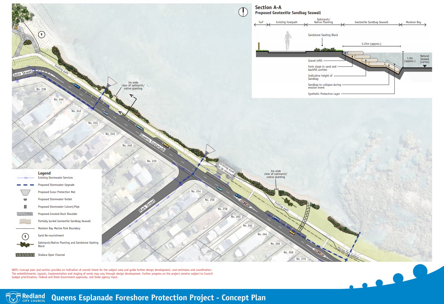
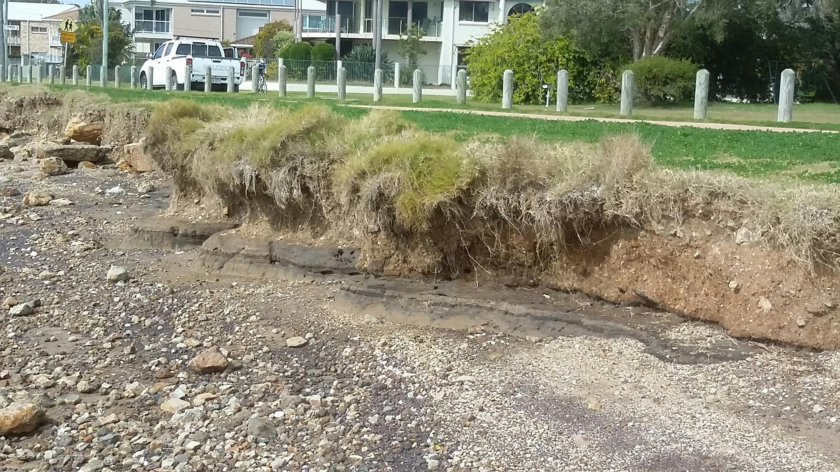
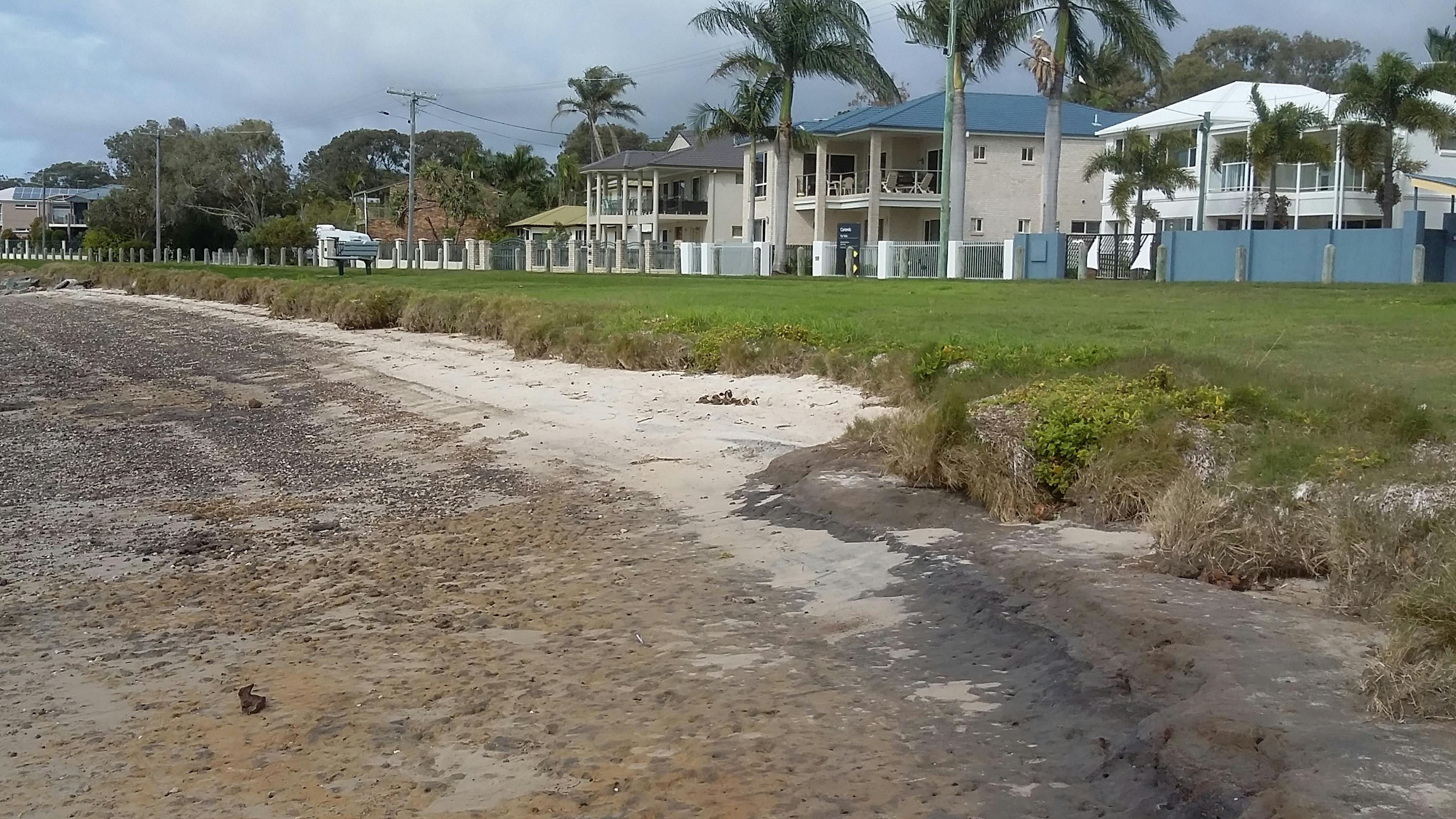
Prevailing winds, high waves, and storm tide inundation impact the adjoining land and vegetation at high tide, causing shoreline erosion. Studies show stormwater run-off is also contributing to erosion in the area.
Council is working towards improving the foreshore by developing a long-term solution to help protect wildlife habitat, environmental and social values and nearby infrastructure.
-
February 2017 project update
Share February 2017 project update on Facebook Share February 2017 project update on X (formerly Twitter) Share February 2017 project update on Linkedin Email February 2017 project update linkThis consultation has concluded.From 11 November to 2 December 2016, Council surveyed local residents, recreational groups and other project stakeholders on its plans to deliver foreshore protection works. A total of 136 surveys were completed.
Participants were questioned on what they did and valued most in the area. The values most commonly nominated as requiring preservation or protection were:
- The outlook and views.
- Easy access to the foreshore, predominantly for use of small watercraft.
- Migratory and resident bird habitat and the natural environment.
- Natural and unspoiled look.
- Walkway and grassed area.
Most participants advised that they supported the construction of a rock wallContinue reading
 3 comments