Coastal Hazard Adaptation Strategy
Consultation has concluded
Planning for the future of Redlands Coast.
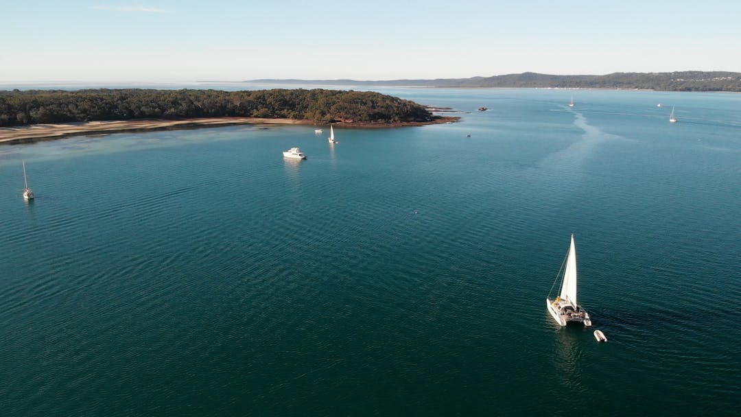
Redland City is blessed with 335 kilometres of coastline and foreshore areas, from Tingalpa Creek at Thorneside south to the mouth of the Logan River and across the Southern Moreton Bay Islands and North Stradbroke Island (Minjerribah). It has a rich and long history and is the traditional and spiritual home of the Quandamooka People.
The coastal zone has significant ecological value and includes Ramsar listed sites and parts of the Moreton Bay Marine Park. Moreton Bay (Quandamooka) provides a habitat for a diverse range of unique plants, and animals including rare, vulnerable, and endangered species such as migratory shorebirds, frogs, dugongs, and turtles.
The coastal environment also holds significant recreational, commercial, and eco-cultural tourism value. The region is renowned for scuba diving, boating, and recreational and commercial fishing. These values have seen Redlands Coast become a popular place for us to live and work and is home to more than 160,000 residents, many of who live adjacent to or within proximity to the coastline.
Redlands Coast experiences regular impacts associated with storm events resulting in erosion and tidal inundation of low-lying areas.
Council is being proactive and developing a long-term comprehensive plan known as the Coastal Hazard Adaptation Strategy to:
- identify coastal hazard areas
- understand vulnerabilities and risks to a range of assets and values
- engage with the community to understand their preferred approach to adaptation
- determine the costs, priorities, and timeframes for their implementation.
Find out more and get involved
- Download Council's Coastal Hazard Adaptation Strategy by clicking here
- Read the project fact sheets
- Register to receive future updates
- Click on a yellow pin on the erosion map below to find out what Council knows about erosion at each site
- Share your knowledge of an area at risk by dragging and dropping a red pin and/or uploading your photos and comments
- Explore Council’s Red-E-Maps to find your property and any related overlays, or browse the overlay maps on the Redland City Plan site
Planning for the future of Redlands Coast.
Redland City is blessed with 335 kilometres of coastline and foreshore areas, from Tingalpa Creek at Thorneside south to the mouth of the Logan River and across the Southern Moreton Bay Islands and North Stradbroke Island (Minjerribah). It has a rich and long history and is the traditional and spiritual home of the Quandamooka People.
The coastal zone has significant ecological value and includes Ramsar listed sites and parts of the Moreton Bay Marine Park. Moreton Bay (Quandamooka) provides a habitat for a diverse range of unique plants, and animals including rare, vulnerable, and endangered species such as migratory shorebirds, frogs, dugongs, and turtles.
The coastal environment also holds significant recreational, commercial, and eco-cultural tourism value. The region is renowned for scuba diving, boating, and recreational and commercial fishing. These values have seen Redlands Coast become a popular place for us to live and work and is home to more than 160,000 residents, many of who live adjacent to or within proximity to the coastline.
Redlands Coast experiences regular impacts associated with storm events resulting in erosion and tidal inundation of low-lying areas.
Council is being proactive and developing a long-term comprehensive plan known as the Coastal Hazard Adaptation Strategy to:
- identify coastal hazard areas
- understand vulnerabilities and risks to a range of assets and values
- engage with the community to understand their preferred approach to adaptation
- determine the costs, priorities, and timeframes for their implementation.
Find out more and get involved
- Download Council's Coastal Hazard Adaptation Strategy by clicking here
- Read the project fact sheets
- Register to receive future updates
- Click on a yellow pin on the erosion map below to find out what Council knows about erosion at each site
- Share your knowledge of an area at risk by dragging and dropping a red pin and/or uploading your photos and comments
- Explore Council’s Red-E-Maps to find your property and any related overlays, or browse the overlay maps on the Redland City Plan site
-
Council adopts city-wide Coastal Hazard Adaptation Strategy
Share Council adopts city-wide Coastal Hazard Adaptation Strategy on Facebook Share Council adopts city-wide Coastal Hazard Adaptation Strategy on X (formerly Twitter) Share Council adopts city-wide Coastal Hazard Adaptation Strategy on Linkedin Email Council adopts city-wide Coastal Hazard Adaptation Strategy linkCLOSED: This discussion has concluded.Redland City Council has today adopted its Coastal Hazard Adaptation Strategy (CHAS), a comprehensive, long-term, coastal hazard management plan.
The CHAS is a city-wide strategy to protect the city’s coastline and islands and includes recommended actions to help Council and other stakeholders, including property owners, adapt to coastal hazards such as erosion, storm tide inundation and sea level rise up to the year 2100.
Redland City Mayor Karen Williams, who chaired the project’s steering committee, said the adoption of the CHAS was a great achievement for both Council and the Redlands Coast community.
“Today, we reached a key milestone in protecting Redlands Coast against coastal hazards,” she said.
“The CHAS assessed the vulnerability of infrastructure, assets and property to coastal hazards and identified a range of city-wide actions and adaptation responses to assist Council and other stakeholders, including property owners, utility providers, local businesses, and community organisations now and into the future.
“The strategy will help us implement cost-effective mitigation measures, manage development and growth, budget for higher costs, collaborate regionally and seek funding opportunities.
“I’d like to thank the community and external advisory group for being a part of this journey and providing feedback into several of the project’s phases and the draft strategy.”
Cr Williams said the CHAS outlined where coastal protection infrastructure and management strategies would be required, as well as the timing and triggers for these interventions.
“The CHAS recommends a range of actions to enhance Redlands Coast’s adaptive capacity by gathering and sharing information that in turn identifies how infrastructure and assets may need to be modified in response to emerging hazards,” she said.
“The next steps for Council include embedding the consideration of coastal hazard risks and adaptation actions into our planning practices and processes, planning and delivering coastal protection works and initiatives based on an improved understanding of risks and impacts and appropriate adaptation responses and timeframes, and engaging utility and service providers to assist them in adapting their infrastructure and assets to coastal hazards, to the benefit of the community.
“The recommended adaption actions will be continually informed by community input and ideas, new knowledge, and monitoring the effectiveness of actions, and I encourage everyone to visit Council’s online project page to view the final CHAS and look through the online resources.”
Council’s CHAS has been developed in line with and is partly funded through the Local Government Association of Queensland’s QCoast2100 program.
Consultation has concludedRedland City Council has today adopted its Coastal Hazard Adaptation Strategy (CHAS), a comprehensive, long-term, coastal hazard management plan.
The CHAS is a city-wide strategy to protect the city’s coastline and islands and includes recommended actions to help Council and other stakeholders, including property owners, adapt to coastal hazards such as erosion, storm tide inundation and sea level rise up to the year 2100.
Redland City Mayor Karen Williams, who chaired the project’s steering committee, said the adoption of the CHAS was a great achievement for both Council and the Redlands Coast community.
“Today, we reached a key milestone in protecting Redlands Coast against coastal hazards,” she said.
“The CHAS assessed the vulnerability of infrastructure, assets and property to coastal hazards and identified a range of city-wide actions and adaptation responses to assist Council and other stakeholders, including property owners, utility providers, local businesses, and community organisations now and into the future.
“The strategy will help us implement cost-effective mitigation measures, manage development and growth, budget for higher costs, collaborate regionally and seek funding opportunities.
“I’d like to thank the community and external advisory group for being a part of this journey and providing feedback into several of the project’s phases and the draft strategy.”
Cr Williams said the CHAS outlined where coastal protection infrastructure and management strategies would be required, as well as the timing and triggers for these interventions.
“The CHAS recommends a range of actions to enhance Redlands Coast’s adaptive capacity by gathering and sharing information that in turn identifies how infrastructure and assets may need to be modified in response to emerging hazards,” she said.
“The next steps for Council include embedding the consideration of coastal hazard risks and adaptation actions into our planning practices and processes, planning and delivering coastal protection works and initiatives based on an improved understanding of risks and impacts and appropriate adaptation responses and timeframes, and engaging utility and service providers to assist them in adapting their infrastructure and assets to coastal hazards, to the benefit of the community.
“The recommended adaption actions will be continually informed by community input and ideas, new knowledge, and monitoring the effectiveness of actions, and I encourage everyone to visit Council’s online project page to view the final CHAS and look through the online resources.”
Council’s CHAS has been developed in line with and is partly funded through the Local Government Association of Queensland’s QCoast2100 program.
-
Council completes final phase of Coastal Hazard Adaptation Strategy
Share Council completes final phase of Coastal Hazard Adaptation Strategy on Facebook Share Council completes final phase of Coastal Hazard Adaptation Strategy on X (formerly Twitter) Share Council completes final phase of Coastal Hazard Adaptation Strategy on Linkedin Email Council completes final phase of Coastal Hazard Adaptation Strategy linkCLOSED: This discussion has concluded.Redland City Council has completed the last phase of its Coastal Hazard Adaptation Strategy (CHAS), bringing it one step closer to finalising the comprehensive long-term climate management plan.
The CHAS is a city-wide strategy for the protection of the city’s coastline and islands and includes recommended actions to help Council and property owners adapt to coastal hazards up to the year 2100.
Mayor Karen Williams, who chairs the project's steering committee, said completion of the strategy’s final phase (phase eight) was a great accomplishment.
“There are still a couple of milestones to be achieved before the project is finalised,” she said.
“Endorsement will be sought from the Local Government Association of Queensland, followed by Council’s review prior to adoption, expected to take place in the next few months.
“Once adopted by Council, the final CHAS will be available on Council’s website.”
The strategy assesses the vulnerability of infrastructure, assets and property to coastal hazards such as coastal erosion, storm tide inundation and sea level rises, identifies a range of adaptation actions and determines costs, priorities and timeframes for their implementation.
The final report brings together an analysis of last year’s community feedback on the draft CHAS, findings from earlier phases, and a summary of the strategy’s implementation plan.
Cr Williams thanked the Redlands Coast community for providing input into the draft strategy, which helped finalise phase eight of the project.
“Consultation throughout the development of the draft CHAS attracted more than 7900 visits to the project’s Your Say web page and 419 people who were actively engaged,” she said.
“Community consultation showed the majority of respondents felt comfortable with the proposed strategy and gave the community the opportunity to present some further ideas for Council’s consideration.”
Community consultation on the draft CHAS occurred in November 2020 and the final report was endorsed by the CHAS steering committee and technical working group in mid-February 2021.
Consultation has concludedRedland City Council has completed the last phase of its Coastal Hazard Adaptation Strategy (CHAS), bringing it one step closer to finalising the comprehensive long-term climate management plan.
The CHAS is a city-wide strategy for the protection of the city’s coastline and islands and includes recommended actions to help Council and property owners adapt to coastal hazards up to the year 2100.
Mayor Karen Williams, who chairs the project's steering committee, said completion of the strategy’s final phase (phase eight) was a great accomplishment.
“There are still a couple of milestones to be achieved before the project is finalised,” she said.
“Endorsement will be sought from the Local Government Association of Queensland, followed by Council’s review prior to adoption, expected to take place in the next few months.
“Once adopted by Council, the final CHAS will be available on Council’s website.”
The strategy assesses the vulnerability of infrastructure, assets and property to coastal hazards such as coastal erosion, storm tide inundation and sea level rises, identifies a range of adaptation actions and determines costs, priorities and timeframes for their implementation.
The final report brings together an analysis of last year’s community feedback on the draft CHAS, findings from earlier phases, and a summary of the strategy’s implementation plan.
Cr Williams thanked the Redlands Coast community for providing input into the draft strategy, which helped finalise phase eight of the project.
“Consultation throughout the development of the draft CHAS attracted more than 7900 visits to the project’s Your Say web page and 419 people who were actively engaged,” she said.
“Community consultation showed the majority of respondents felt comfortable with the proposed strategy and gave the community the opportunity to present some further ideas for Council’s consideration.”
Community consultation on the draft CHAS occurred in November 2020 and the final report was endorsed by the CHAS steering committee and technical working group in mid-February 2021.
-
Submissions closed
Share Submissions closed on Facebook Share Submissions closed on X (formerly Twitter) Share Submissions closed on Linkedin Email Submissions closed linkCLOSED: This discussion has concluded.Submissions on Council's draft Coastal Hazard Adaptation Strategy is now closed.
Council will now commence a review of the feedback and incorporate it in the final CHAS, where possible.
Future project updates will be posted on this page.
To download the draft strategy, click here.
Consultation has concludedSubmissions on Council's draft Coastal Hazard Adaptation Strategy is now closed.
Council will now commence a review of the feedback and incorporate it in the final CHAS, where possible.
Future project updates will be posted on this page.
To download the draft strategy, click here.
-
Draft CHAS available for review
Share Draft CHAS available for review on Facebook Share Draft CHAS available for review on X (formerly Twitter) Share Draft CHAS available for review on Linkedin Email Draft CHAS available for review linkCLOSED: This discussion has concluded.Redland City Council has completed its draft Coastal Hazard Adaptation Strategy (CHAS).
The CHAS is a city-wide strategy for the protection of our coastline and islands comprising of a range of initiatives to help Council and property owners adapt to coastal hazards, including storm tide inundation, sea level rise, and coastal erosion, now and into the future.
Development of the CHAS has been informed by technical assessments and engagement activities with stakeholders and the community from 2018 to 2020.
Location-specific adaptation actions are set out in pathways from present-day to 2100 for each of the 16 coastal localities across Redlands Coast. These actions are informed by the changing risk profile, economic analysis, and broader objectives for management.
Examples of adaptation actions include:
- City-wide environmental stewardship programs, including vegetation enhancement for important mangrove areas and dune systems
- Enhancing community resilience and adaptative capacity
- Monitoring programs to inform future adaptation planning
- Informing infrastructure upgrades and programs
- Establishing collaborative research partnerships
- Updating design guidelines for key infrastructure
- Implementing Shoreline Erosion Management Plans
- Reviewing opportunities to improve drainage networks
- Reviewing funding models and mechanisms for shared public and private works
Adaptation pathways will be continually informed by community input and ideas, new knowledge, and monitoring the effectiveness of actions.
The draft CHAS is out for public consultation from 19 November to 18 December 2020. To view the document click here and to make a submission click on the 'Make a submission' tab on this page.
Consultation has concludedRedland City Council has completed its draft Coastal Hazard Adaptation Strategy (CHAS).
The CHAS is a city-wide strategy for the protection of our coastline and islands comprising of a range of initiatives to help Council and property owners adapt to coastal hazards, including storm tide inundation, sea level rise, and coastal erosion, now and into the future.
Development of the CHAS has been informed by technical assessments and engagement activities with stakeholders and the community from 2018 to 2020.
Location-specific adaptation actions are set out in pathways from present-day to 2100 for each of the 16 coastal localities across Redlands Coast. These actions are informed by the changing risk profile, economic analysis, and broader objectives for management.
Examples of adaptation actions include:
- City-wide environmental stewardship programs, including vegetation enhancement for important mangrove areas and dune systems
- Enhancing community resilience and adaptative capacity
- Monitoring programs to inform future adaptation planning
- Informing infrastructure upgrades and programs
- Establishing collaborative research partnerships
- Updating design guidelines for key infrastructure
- Implementing Shoreline Erosion Management Plans
- Reviewing opportunities to improve drainage networks
- Reviewing funding models and mechanisms for shared public and private works
Adaptation pathways will be continually informed by community input and ideas, new knowledge, and monitoring the effectiveness of actions.
The draft CHAS is out for public consultation from 19 November to 18 December 2020. To view the document click here and to make a submission click on the 'Make a submission' tab on this page.
-
Have your say on Council's draft coastal hazard adaptation strategy
Share Have your say on Council's draft coastal hazard adaptation strategy on Facebook Share Have your say on Council's draft coastal hazard adaptation strategy on X (formerly Twitter) Share Have your say on Council's draft coastal hazard adaptation strategy on Linkedin Email Have your say on Council's draft coastal hazard adaptation strategy linkCLOSED: This discussion has concluded.Redland City Council is inviting community members to have their say on its draft Coastal Hazard Adaptation Strategy (CHAS) after the project’s consultation phase was endorsed at today’s Council meeting.
The CHAS is a city-wide strategy for the city’s coastline and islands that will assess the vulnerability of infrastructure, assets, and property to coastal hazards such as coastal erosion, storm tide inundation, and sea level rise.
The strategy also recommends actions for Council and property owners to adapt to the challenges up to the years 2070 and 2100.
Mayor Karen Williams, who also chairs the project’s steering committee, said this consultation period was an essential step in finalising Council’s long-term, comprehensive, climate adaptation plan.
“After years of extensive coastal studies and investigations to determine the risk of existing and future coastal hazard impacts on Redlands Coast, Council’s draft CHAS is ready to be reviewed by our community,” she said.
“As a city of islands with approximately 335km of coastline, it is vital that we do this work to assess the vulnerabilities and risks posed by potential changes to our coastline, and determine the best ways to manage our public areas and assets.
“The draft strategy considers land and assets that may be impacted by coastal hazards.”
Cr Williams said the draft CHAS had been developed in line with the Queensland Government and the Local Government Association of Queensland’s QCoast2100 program, with Redland City Council being one of more than 30 coastal councils in Queensland doing this planning.
“Ultimately, the CHAS will help us implement cost-effective mitigation measures, plan for development and growth, budget for higher costs, collaborate regionally, and seek investment opportunities,” she said.
“Now we want to receive the community’s feedback about the draft strategy.”
Cr Williams said that due to COVID-safe requirements, community workshops on the draft strategy would not be held, with community consultation to take place online via the project’s page on Council’s Your Say website.
“It is important that we all work together to help keep everyone safe during these times, and people can visit Council’s Your Say page for a copy of the draft strategy and make a submission on it,” she said.
“I urge all community members to participate in this important project to help protect the future of Redlands Coast.”
The CHAS is scheduled for completion in April 2021 following a review of community feedback and Council’s adoption of the strategy.
Consultation starts on Thursday 19 November 2020 and closes on Friday 18 December 2020.
Consultation has concludedRedland City Council is inviting community members to have their say on its draft Coastal Hazard Adaptation Strategy (CHAS) after the project’s consultation phase was endorsed at today’s Council meeting.
The CHAS is a city-wide strategy for the city’s coastline and islands that will assess the vulnerability of infrastructure, assets, and property to coastal hazards such as coastal erosion, storm tide inundation, and sea level rise.
The strategy also recommends actions for Council and property owners to adapt to the challenges up to the years 2070 and 2100.
Mayor Karen Williams, who also chairs the project’s steering committee, said this consultation period was an essential step in finalising Council’s long-term, comprehensive, climate adaptation plan.
“After years of extensive coastal studies and investigations to determine the risk of existing and future coastal hazard impacts on Redlands Coast, Council’s draft CHAS is ready to be reviewed by our community,” she said.
“As a city of islands with approximately 335km of coastline, it is vital that we do this work to assess the vulnerabilities and risks posed by potential changes to our coastline, and determine the best ways to manage our public areas and assets.
“The draft strategy considers land and assets that may be impacted by coastal hazards.”
Cr Williams said the draft CHAS had been developed in line with the Queensland Government and the Local Government Association of Queensland’s QCoast2100 program, with Redland City Council being one of more than 30 coastal councils in Queensland doing this planning.
“Ultimately, the CHAS will help us implement cost-effective mitigation measures, plan for development and growth, budget for higher costs, collaborate regionally, and seek investment opportunities,” she said.
“Now we want to receive the community’s feedback about the draft strategy.”
Cr Williams said that due to COVID-safe requirements, community workshops on the draft strategy would not be held, with community consultation to take place online via the project’s page on Council’s Your Say website.
“It is important that we all work together to help keep everyone safe during these times, and people can visit Council’s Your Say page for a copy of the draft strategy and make a submission on it,” she said.
“I urge all community members to participate in this important project to help protect the future of Redlands Coast.”
The CHAS is scheduled for completion in April 2021 following a review of community feedback and Council’s adoption of the strategy.
Consultation starts on Thursday 19 November 2020 and closes on Friday 18 December 2020.
-
September 2020 Update
Share September 2020 Update on Facebook Share September 2020 Update on X (formerly Twitter) Share September 2020 Update on Linkedin Email September 2020 Update linkCLOSED: This discussion has concluded.Council's Coastal Hazard Adaptation Strategy (CHAS) is underway and due for completion in early-2021. However, before the CHAS is finalised, Council wants to hear what you think about its long-term comprehensive plan. The plan will assess the vulnerability of infrastructure, assets, and property to coastal hazards, and recommend actions to help adapt and mitigate these risks.
Council will present the Draft CHAS for four-weeks of community consultation in November 2020. More details about this engagement phase, and how to submit feedback on the strategy, will be announced soon.
In the meantime, be sure to read the new September 2020 Project Update fact sheet available in the 'Documents and Fact Sheets' section of this page. The fact sheet provides information on the different adaptation options the CHAS could identify, its development to date, and a brief summary of the community survey results.
Stay tuned for future announcements.
Consultation has concludedCouncil's Coastal Hazard Adaptation Strategy (CHAS) is underway and due for completion in early-2021. However, before the CHAS is finalised, Council wants to hear what you think about its long-term comprehensive plan. The plan will assess the vulnerability of infrastructure, assets, and property to coastal hazards, and recommend actions to help adapt and mitigate these risks.
Council will present the Draft CHAS for four-weeks of community consultation in November 2020. More details about this engagement phase, and how to submit feedback on the strategy, will be announced soon.
In the meantime, be sure to read the new September 2020 Project Update fact sheet available in the 'Documents and Fact Sheets' section of this page. The fact sheet provides information on the different adaptation options the CHAS could identify, its development to date, and a brief summary of the community survey results.
Stay tuned for future announcements.
-
Survey closed
Share Survey closed on Facebook Share Survey closed on X (formerly Twitter) Share Survey closed on Linkedin Email Survey closed linkCLOSED: This discussion has concluded.The CHAS Phase 6 'Our Coastal Values and Experiences Survey' closed at midnight on Friday 24 July 2020.
Thank you to everyone who provided their feedback to Council.
There will be further opportunities for community consultation in the coming months as the project team continues to seek feedback on the CHAS.
Stay tuned!
Consultation has concludedThe CHAS Phase 6 'Our Coastal Values and Experiences Survey' closed at midnight on Friday 24 July 2020.
Thank you to everyone who provided their feedback to Council.
There will be further opportunities for community consultation in the coming months as the project team continues to seek feedback on the CHAS.
Stay tuned!
-
Council seeks community input on coastal strategy
Share Council seeks community input on coastal strategy on Facebook Share Council seeks community input on coastal strategy on X (formerly Twitter) Share Council seeks community input on coastal strategy on Linkedin Email Council seeks community input on coastal strategy linkCLOSED: This discussion has concluded.June 2020
Redland City Council is inviting community members to provide input into Phase 6 of its Coastal Hazard Adaptation Strategy.
A city-wide strategy for the protection of the city’s coastline, including islands and inland rivers and creeks; the project will assess the vulnerability of infrastructure, assets and property to coastal hazards, and recommend actions to help adapt and manage these risks.
As part of the project’s next phase, Council is conducting an online survey seeking feedback from community members on what they value most about Redlands Coast, plus their understanding and any experiences of coastal hazards.
Mayor Karen Williams, who is also chairperson of the project’s steering committee, said the next phase involved identifying options that would help Redlands Coast adapt to, and be protected from, potential hazards such as coastal erosion, storm tide inundation, and sea level rise to the years 2070 and 2100.
“I’m very proud of this project and I’m looking forward to its completion later this year,” Cr Williams said.
“Council and project stakeholders have worked hard in developing the Coastal Hazard Adaptation Strategy, and this next phase calls for the community to provide invaluable input to help inform the strategy’s recommended actions.
“Redlands Coast residents should feel confident knowing Council will have a plan in place to help protect our coastal lifestyle, Indigenous cultural heritage, and to guide the adaptation of private property and public infrastructure.”
Development of the strategy is overseen by the project’s steering committee, and is developed in consultation with the Quandamooka Yoolooburrabee Aboriginal Corporation, key asset owners and stakeholder bodies, and the wider Redlands Coast community.
Consultation has concludedJune 2020
Redland City Council is inviting community members to provide input into Phase 6 of its Coastal Hazard Adaptation Strategy.
A city-wide strategy for the protection of the city’s coastline, including islands and inland rivers and creeks; the project will assess the vulnerability of infrastructure, assets and property to coastal hazards, and recommend actions to help adapt and manage these risks.
As part of the project’s next phase, Council is conducting an online survey seeking feedback from community members on what they value most about Redlands Coast, plus their understanding and any experiences of coastal hazards.
Mayor Karen Williams, who is also chairperson of the project’s steering committee, said the next phase involved identifying options that would help Redlands Coast adapt to, and be protected from, potential hazards such as coastal erosion, storm tide inundation, and sea level rise to the years 2070 and 2100.
“I’m very proud of this project and I’m looking forward to its completion later this year,” Cr Williams said.
“Council and project stakeholders have worked hard in developing the Coastal Hazard Adaptation Strategy, and this next phase calls for the community to provide invaluable input to help inform the strategy’s recommended actions.
“Redlands Coast residents should feel confident knowing Council will have a plan in place to help protect our coastal lifestyle, Indigenous cultural heritage, and to guide the adaptation of private property and public infrastructure.”
Development of the strategy is overseen by the project’s steering committee, and is developed in consultation with the Quandamooka Yoolooburrabee Aboriginal Corporation, key asset owners and stakeholder bodies, and the wider Redlands Coast community.
-
Council continues to make progress on its CHAS
Share Council continues to make progress on its CHAS on Facebook Share Council continues to make progress on its CHAS on X (formerly Twitter) Share Council continues to make progress on its CHAS on Linkedin Email Council continues to make progress on its CHAS linkCLOSED: This discussion has concluded.Phase 3 and 4 have been completed, reviewed and accepted by the Local Government Association of Queensland (LGAQ). These phases of the project focused on identifying areas exposed to current and future coastal hazards and identifying assets that will potentially be impacted by these hazards. The project's Technical Working Group and Steering Committee both provided valuable input in refining this work.
In February 2020, Phase 5 of the strategy was submitted for review and approval to the LGAQ. This phase involved estimating the level of risk posed to key assets or locations that could be impacted by coastal hazards –Continue reading
Consultation has concludedPhase 3 and 4 have been completed, reviewed and accepted by the Local Government Association of Queensland (LGAQ). These phases of the project focused on identifying areas exposed to current and future coastal hazards and identifying assets that will potentially be impacted by these hazards. The project's Technical Working Group and Steering Committee both provided valuable input in refining this work.
In February 2020, Phase 5 of the strategy was submitted for review and approval to the LGAQ. This phase involved estimating the level of risk posed to key assets or locations that could be impacted by coastal hazards – considering the likelihood and the consequence of potential impacts.
The project's remaining phases (Phase 6-8) has been awarded to coastal consulting organisation, Alluvium.
Work has now begun on Phase 6 in which a range of potential adaptation options will be identified to manage the risk, coastal hazards pose, to a wide range of coastal assets and values.
The full range of options will be evaluated and analysed in Phase 7 later this year using social, environmental and economic criteria to help Council and other stakeholders to prepare for and make decisions on how they can respond to coastal hazards.
-
CHAS update
Share CHAS update on Facebook Share CHAS update on X (formerly Twitter) Share CHAS update on Linkedin Email CHAS update linkCLOSED: This discussion has concluded.On Tuesday 23 July, the CHAS steering committee meeting was held. Consultants presented the reports for phases three and four of the strategy that looked at identifying the hazards and assets at risk, respectively. Council and the Local Government Association of Queensland are currently examining the reports.
The State is also set to review the revised Erosion Prone Area (EPA) mapping. The EPA will replace the current State mapping.
Consultation has concludedOn Tuesday 23 July, the CHAS steering committee meeting was held. Consultants presented the reports for phases three and four of the strategy that looked at identifying the hazards and assets at risk, respectively. Council and the Local Government Association of Queensland are currently examining the reports.
The State is also set to review the revised Erosion Prone Area (EPA) mapping. The EPA will replace the current State mapping.
CHAS Explainer Video
-
 Click here to play video
Watch the CHAS video to find out more about the project.
Click here to play video
Watch the CHAS video to find out more about the project.

Fact Sheets
-
 CHAS Terminology Fact Sheet 1 (1.45 MB) (pdf)
-
Coastal Landscape and Hazards Fact Sheet 2 (1.73 MB) (pdf)
-
Coastal Resilience and Adaptation Fact Sheet 3 (3.95 MB) (pdf)
-
Economics Fact Sheet 4 (1.96 MB) (pdf)
-
Adaptation Framework Fact Sheet 5 (1.41 MB) (pdf)
-
CHAS Adaptation Actions Sheets (3.55 MB) (pdf)
-
CHAS Progress Update Fact Sheet - September 2020 (880 KB) (pdf)
Key Milestones
-
2018 - Phase 1: Develop a communication and stakeholder engagement plan
Coastal Hazard Adaptation Strategy has finished this stage -
2018 - Phase 2: Scope coastal hazard issues for Redland City
Coastal Hazard Adaptation Strategy has finished this stage -
2019 - Phase 3: Identify areas exposed to current and future coastal hazards
Coastal Hazard Adaptation Strategy has finished this stage -
2019 - Phase 4: Identify key assets in Redland City that may be impacted
Coastal Hazard Adaptation Strategy has finished this stage -
2020 - Phase 5: Undertake a risk assessment of the identified key assets in coastal hazard areas
Coastal Hazard Adaptation Strategy has finished this stage -
2020 - Phase 6: Identify potential adaptation options
Coastal Hazard Adaptation Strategy has finished this stage -
2020 - Phase 7: Undertake a socioeconomic evaluation of the identified adaptation options
Coastal Hazard Adaptation Strategy has finished this stage -
2020 - Phase 8: Community feedback sought on draft CHAS
Coastal Hazard Adaptation Strategy has finished this stage -
2021 - Phase 8: Review and incorporate feedback into final CHAS
Coastal Hazard Adaptation Strategy has finished this stage -
2021 - Phase 8: Present final CHAS to Council for adoption
Coastal Hazard Adaptation Strategy has finished this stage -
2021 - CHAS adopted by Council
Coastal Hazard Adaptation Strategy is currently at this stage
