Share Refining EPA mapping on Facebook
Share Refining EPA mapping on X (formerly Twitter)
Share Refining EPA mapping on Linkedin
Email Refining EPA mapping link
Council is in the process of further refining the Coastal Protection (erosion prone areas) Overlay, in consultation with the state Department of Environment and Science (DES), to recognise areas already protected from erosion.
These include areas protected by natural means (i.e. hard, rocky outcrops) and man-made measures (i.e. revetment walls).
Once finalised this will feed into Phases 3 and 4 of the CHAS.
Share Status update on Facebook
Share Status update on X (formerly Twitter)
Share Status update on Linkedin
Email Status update link
Council has completed the Communication and Engagement Plan (CEP) which is Phase 1 of the CHAS. This plan identifies education programs to help Redlands residents understand coastal hazards and their impacts and articulates how and when key stakeholders will be engaged. The Scoping/Gap Analysis (Phase 2) has also been completed which identifies any gaps in Council's knowledge that may be required to move forward with the Strategy.
At the time of writing, Phases 3 and 4 are estimated to be completed by April 2019. Phase 3 identifies the areas of Redlands Coast exposed to current and future coastal hazards. PhaseContinue reading
Council has completed the Communication and Engagement Plan (CEP) which is Phase 1 of the CHAS. This plan identifies education programs to help Redlands residents understand coastal hazards and their impacts and articulates how and when key stakeholders will be engaged. The Scoping/Gap Analysis (Phase 2) has also been completed which identifies any gaps in Council's knowledge that may be required to move forward with the Strategy.
At the time of writing, Phases 3 and 4 are estimated to be completed by April 2019. Phase 3 identifies the areas of Redlands Coast exposed to current and future coastal hazards. Phase 4 then drills down looking at key assets within those areas that may potentially be impacted.
Share Technical Working Group formed on Facebook
Share Technical Working Group formed on X (formerly Twitter)
Share Technical Working Group formed on Linkedin
Email Technical Working Group formed link
Redland City Council has formed a technical working group made up of key internal stakeholders to ensure technical excellence throughout the development of the CHAS. Members are drawn from asset management, city planning, environment, disaster management, risk management, and strategy and governance.
Their role is to review each milestone of the CHAS, providing guidance and bringing their professional expertise to the table.
Share Coastal Hazards Adaptation Strategy: Part 2- Emerging Hazards on Facebook
Share Coastal Hazards Adaptation Strategy: Part 2- Emerging Hazards on X (formerly Twitter)
Share Coastal Hazards Adaptation Strategy: Part 2- Emerging Hazards on Linkedin
Email Coastal Hazards Adaptation Strategy: Part 2- Emerging Hazards link
The Draft Coastal Adaptation Strategy: Part 1 - Current Hazards is final and was endorsed by Council in December 2016. This work identified those areas on Redlands Coast that are currently subject to erosion, and recommended appropriate and sustainable management of these areas.This report will remain in draft until Part 2 is finalised in 2020.
The Coastal Hazards Adaptation Strategy (CHAS): Part 2 - Emerging Hazards is now under development and builds on the existing hazards that were identified in Phase 1. The Strategy development and delivery is overseen by a high-level Coastal Adaptation Steering Committee chaired by Redland City'sContinue reading
The Draft Coastal Adaptation Strategy: Part 1 - Current Hazards is final and was endorsed by Council in December 2016. This work identified those areas on Redlands Coast that are currently subject to erosion, and recommended appropriate and sustainable management of these areas.This report will remain in draft until Part 2 is finalised in 2020.
The Coastal Hazards Adaptation Strategy (CHAS): Part 2 - Emerging Hazards is now under development and builds on the existing hazards that were identified in Phase 1. The Strategy development and delivery is overseen by a high-level Coastal Adaptation Steering Committee chaired by Redland City's Mayor, which involves senior State Government representatives who provide advice on the progress of the CHAS.
The Queensland State Government's QCoast 2100: Minimum Standards and Guideline for Queensland Local Governments, underpins the development of this second stage of the Strategy, enabling Councils to focus forward and consider the future coastal hazards and their impacts out to the year 2100.
QCoast2100 also provides funding through the Local Government Association of Queensland (LGAQ), to facilitate the delivery of the eight-phase process which is outlined in the attached figure.
Redland City Council is currently completing Phases 3 and 4, and expects the Strategy to be completed by October 2020.

Share June 2018 Update on Facebook
Share June 2018 Update on X (formerly Twitter)
Share June 2018 Update on Linkedin
Email June 2018 Update link
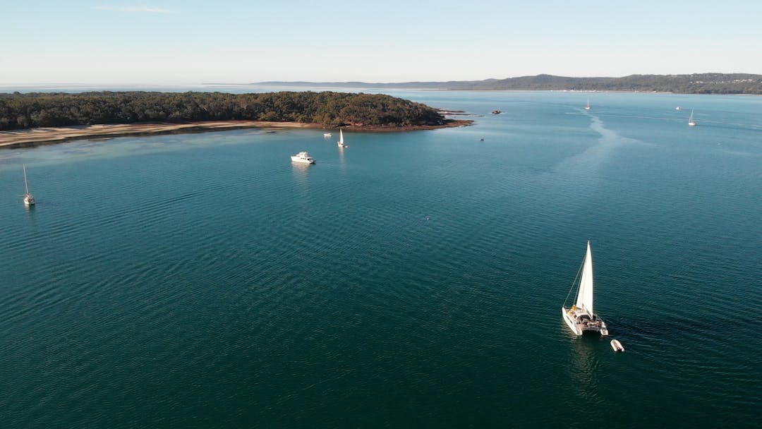
From April 2017 to the end of July 2017, Council consulted with local communities and special interest groups about coastal erosion.
Consultation included distribution of local area maps showing nearby erosion locations, on-site engagement events at key erosion locations, stakeholder briefings and more.
Council also did surveys to find out how the community used these areas, and identify what the community and stakeholders wanted to see preserved and protected at these locations.
Feedback ranged across interests and included the need to preserve: easy access to popular beaches, important Indigenous and European heritage sites, infrastructure, and the intertidal zone which isContinue reading
From April 2017 to the end of July 2017, Council consulted with local communities and special interest groups about coastal erosion.
Consultation included distribution of local area maps showing nearby erosion locations, on-site engagement events at key erosion locations, stakeholder briefings and more.
Council also did surveys to find out how the community used these areas, and identify what the community and stakeholders wanted to see preserved and protected at these locations.
Feedback ranged across interests and included the need to preserve: easy access to popular beaches, important Indigenous and European heritage sites, infrastructure, and the intertidal zone which is important for migratory birds.
Thousands of people participated in the consultation process.
Community consultation also led to the identification of additional sites, which following assessment may be added to the list of 44 currently recognised erosion prone locations.
Keep an eye out for the next phase of community consultation, with workshops starting in August 2018.


 CHAS Terminology Fact Sheet 1 (1.45 MB) (pdf)
