Coochiemudlo Island Shoreline Erosion Management Plan
Share Coochiemudlo Island Shoreline Erosion Management Plan on Facebook Share Coochiemudlo Island Shoreline Erosion Management Plan on Twitter Share Coochiemudlo Island Shoreline Erosion Management Plan on Linkedin Email Coochiemudlo Island Shoreline Erosion Management Plan link

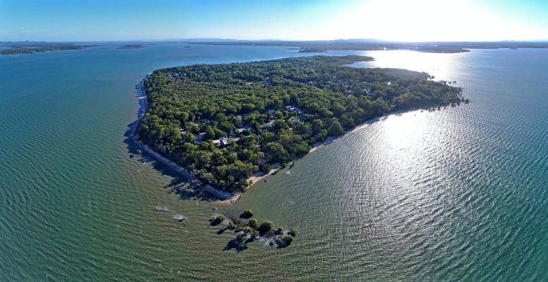
Coochiemudlo Island (Goochie Mudlo) is located off the coast of southeast Queensland in the southern part of Moreton Bay (Quandamooka).

With an emerald fringe of native plants and trees, caves, and beaches, Coochiemudlo Island and surrounding waters are home to an array of wildlife, including migratory shorebirds, dugongs, turtles, dolphins and soldier crabs.

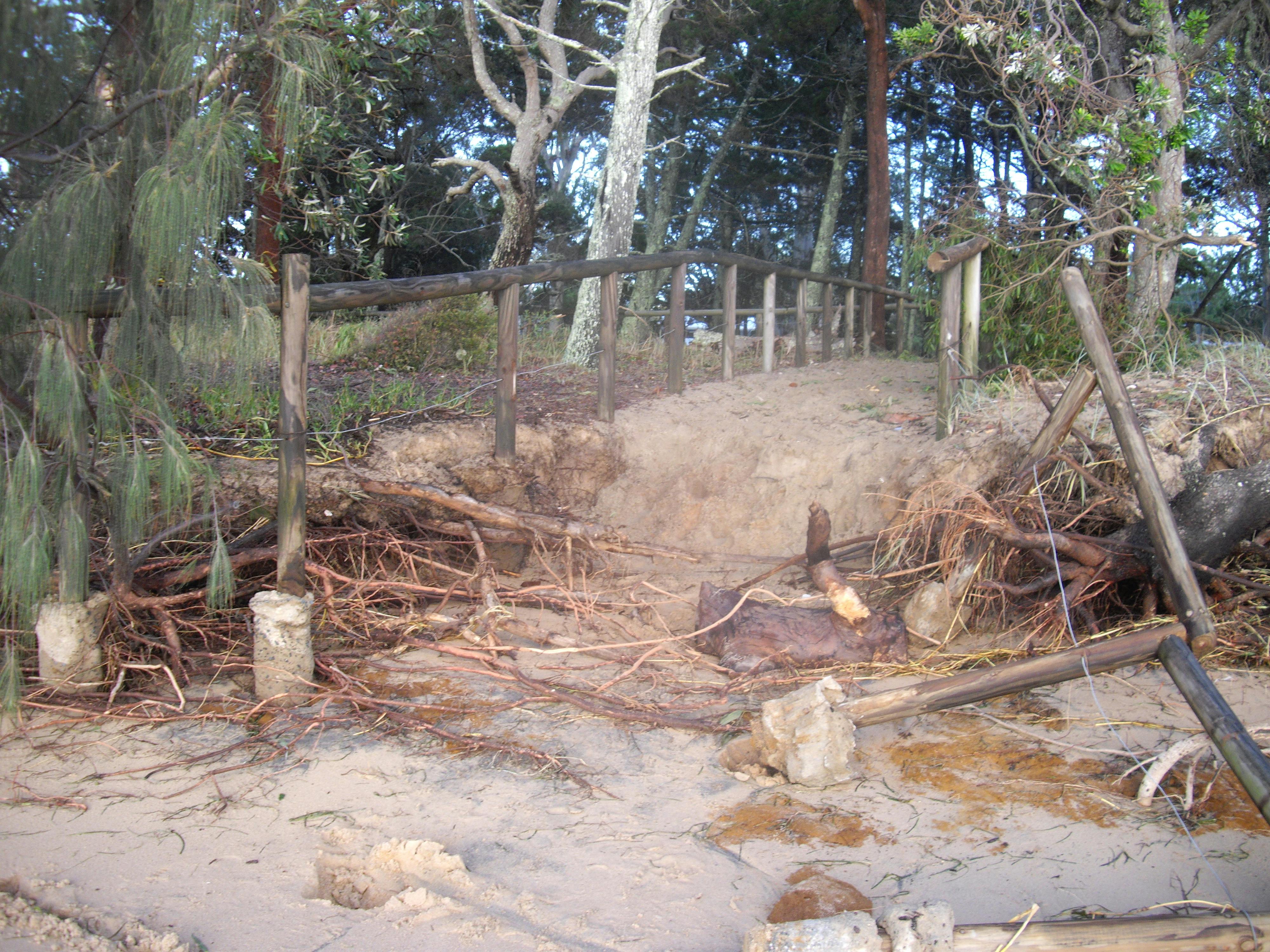
Parts of this small, sub-tropical island, however, are subject to coastal erosion brought on by weather events and storm tide inundation.

Redland City Council, with input from the Community Reference Group (CRG) and other stakeholder groups, has developed a comprehensive plan known as a Shoreline Erosion Management Plan (SEMP) to identify the island's erosion hotspots and recommend the most suitable management options to help protect the island from coastal erosion.

What is the Community Reference Group?

The SEMP's CRG represents a cross-section of the island community and includes representatives from Quandamooka Yoolooburrabee Aboriginal Corporation.

The CRG brings together Traditional Owners and local stakeholders to contribute their local knowledge of erosion, as well as the wider cultural, historical, environmental, and economic values of the island.

This group has contributed by sharing information, insights, and progress reports back to their community networks.

Find out more

  • Read the Coochiemudlo Island SEMP located in the 'Documents' section
  • Download project fact sheets located in the 'Fact Sheets' section
  • Check out the latest project updates
  • Learn about other similar projects, like the Coochiemudlo Island SEMP and the Coastal Hazard Adaptation Strategy in the 'Related Projects' section

Have a question?

Have a question about the Coochiemudlo Island Shoreline Erosion Management Plan? Ask away!

You need to be signed in to add your question.

  • Share Approximately 18 months ago there was considerable amount of erosion on the shoreline of Norfolk Beach which was addressed by building a sand bag wall. This solution would appear to have been successful. Why can't the same solution be put in place for the rest of the shoreline on Norfolk beach as the erosion is quiet significant on Facebook Share Approximately 18 months ago there was considerable amount of erosion on the shoreline of Norfolk Beach which was addressed by building a sand bag wall. This solution would appear to have been successful. Why can't the same solution be put in place for the rest of the shoreline on Norfolk beach as the erosion is quiet significant on Twitter Share Approximately 18 months ago there was considerable amount of erosion on the shoreline of Norfolk Beach which was addressed by building a sand bag wall. This solution would appear to have been successful. Why can't the same solution be put in place for the rest of the shoreline on Norfolk beach as the erosion is quiet significant on Linkedin Email Approximately 18 months ago there was considerable amount of erosion on the shoreline of Norfolk Beach which was addressed by building a sand bag wall. This solution would appear to have been successful. Why can't the same solution be put in place for the rest of the shoreline on Norfolk beach as the erosion is quiet significant link

    Approximately 18 months ago there was considerable amount of erosion on the shoreline of Norfolk Beach which was addressed by building a sand bag wall. This solution would appear to have been successful. Why can't the same solution be put in place for the rest of the shoreline on Norfolk beach as the erosion is quiet significant

    Madonna asked almost 3 years ago

    Hi Madonna,

    Thank you for your enquiry regarding the Coochiemudlo Island Shoreline Erosion Management Plan (SEMP).

    Redland City Council (Council) engaged environmental consultant BMT to develop the SEMP to provide strategic direction for the sustainable use of Coochiemudlo Island's coastal zone and facilitate coordinated planning of long-term shoreline erosion management options. Council also consulted with the SEMP's Community Reference Group throughout the development of the SEMP.

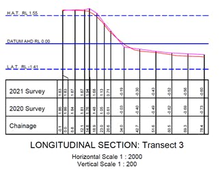
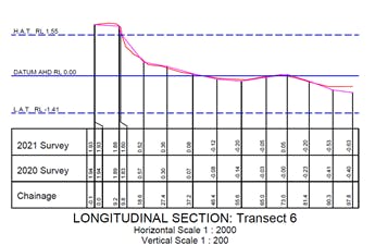
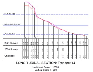
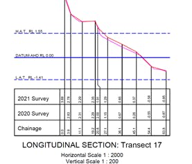
    To identify the most suitable management options for Coochiemudlo Island, BMT investigated the coastal processes and environmental, social, economic, and cultural needs of the island, which can be viewed in the Shoreline Erosion Management Study here.

    The existing geotextile sandbag seawall on Norfolk Beach is an unapproved structure, and retaining the seawall is dependent on State Government approval. Council has lodged an application with the State Government that requests approval of the structure, however, the outcome of this application has not been finalised.

    An option to build additional seawalls on Coochiemudlo Island was considered, as part of the SEMP, however, it was not recommended as a viable management option. While a seawall can protect inland assets from erosion, it effectively isolates the sand located behind the wall from the active beach system and may lead to other adverse consequences. On an eroding shoreline, and over time, the seawall becomes progressively further seaward and without ongoing beach nourishment, will result in total loss of the beach.

    The SEMP has recommended that Council undertake beach nourishment to replace the loss of sand that has resulted from storm events at Norfolk Beach. Beach recovery naturally occurs following erosion of this nature and beach nourishment accelerates this process, and adds resilience to the beach against future weather events. To view a copy of the SEMP, click here.

    Council will keep the community informed as more details regarding the implementation of the SEMP becomes available.

    Kind regards,

    The Coochiemudlo Island SEMP Project Team

Page last updated: 14 Dec 2021, 02:48 PM