Coochiemudlo Island Shoreline Erosion Management Plan
Consultation has concluded
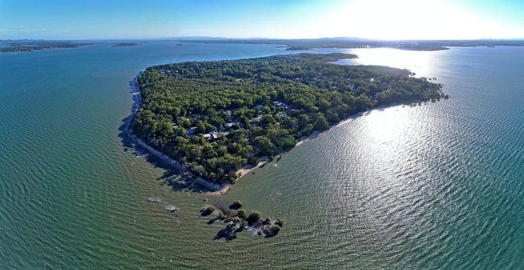
Coochiemudlo Island (Goochie Mudlo) is located off the coast of southeast Queensland in the southern part of Moreton Bay (Quandamooka).
With an emerald fringe of native plants and trees, caves, and beaches, Coochiemudlo Island and surrounding waters are home to an array of wildlife, including migratory shorebirds, dugongs, turtles, dolphins and soldier crabs.
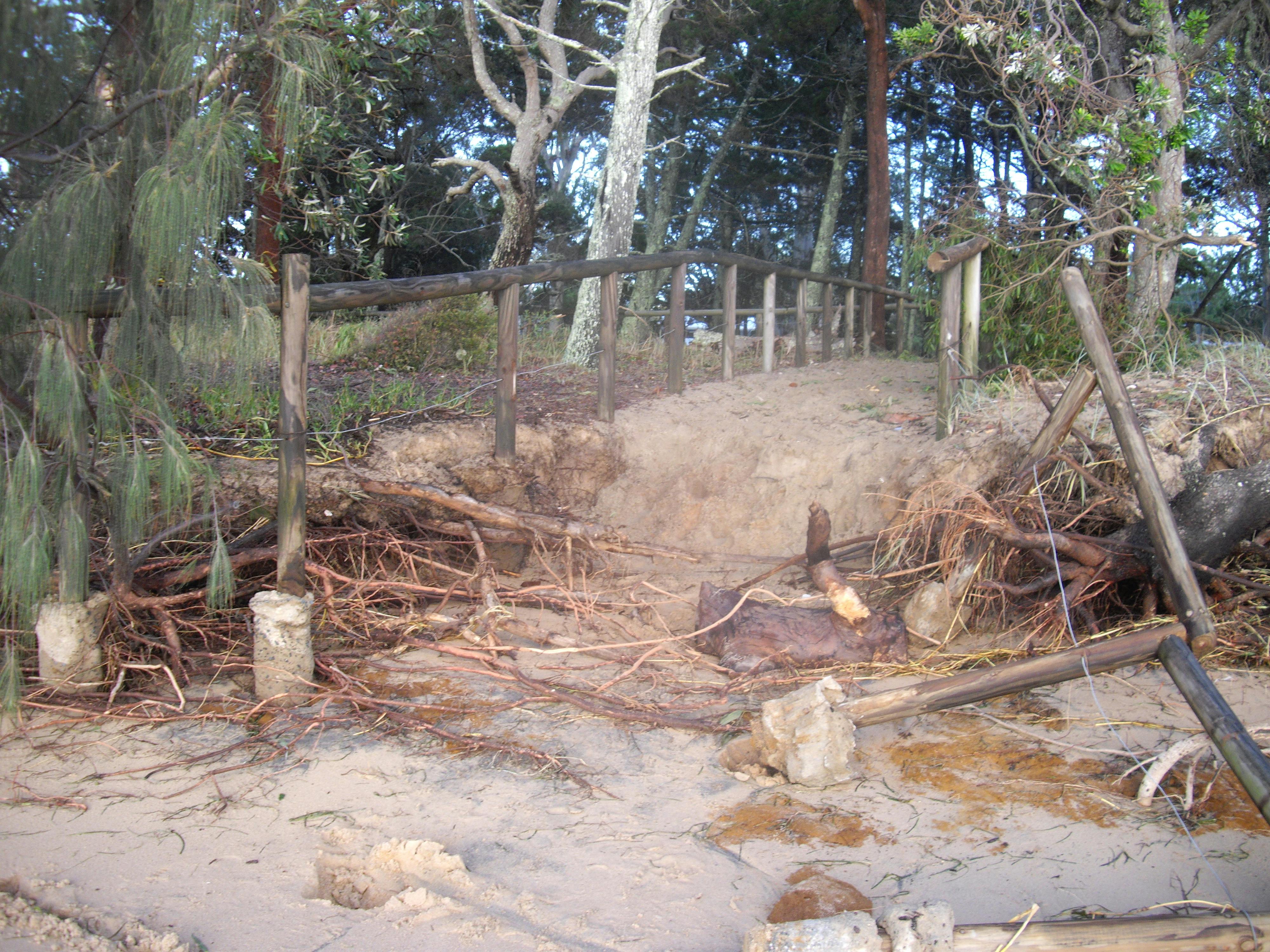
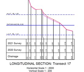
Parts of this small, sub-tropical island, however, are subject to coastal erosion brought on by weather events and storm tide inundation.
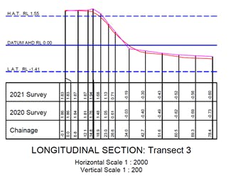
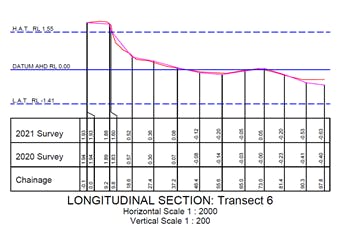
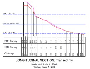
Redland City Council, with input from the Community Reference Group (CRG) and other stakeholder groups, has developed a comprehensive plan known as a Shoreline Erosion Management Plan (SEMP) to identify the island's erosion hotspots and recommend the most suitable management options to help protect the island from coastal erosion.
What is the Community Reference Group?
The SEMP's CRG represents a cross-section of the island community and includes representatives from Quandamooka Yoolooburrabee Aboriginal Corporation.
The CRG brings together Traditional Owners and local stakeholders to contribute their local knowledge of erosion, as well as the wider cultural, historical, environmental, and economic values of the island.
This group has contributed by sharing information, insights, and progress reports back to their community networks.
Find out more
- Read the Coochiemudlo Island SEMP located in the 'Documents' section
- Download project fact sheets located in the 'Fact Sheets' section
- Check out the latest project updates
- Learn about other similar projects, like the Coochiemudlo Island SEMP and the Coastal Hazard Adaptation Strategy in the 'Related Projects' section