Amity Point Shoreline Erosion Management Plan
Consultation has concluded
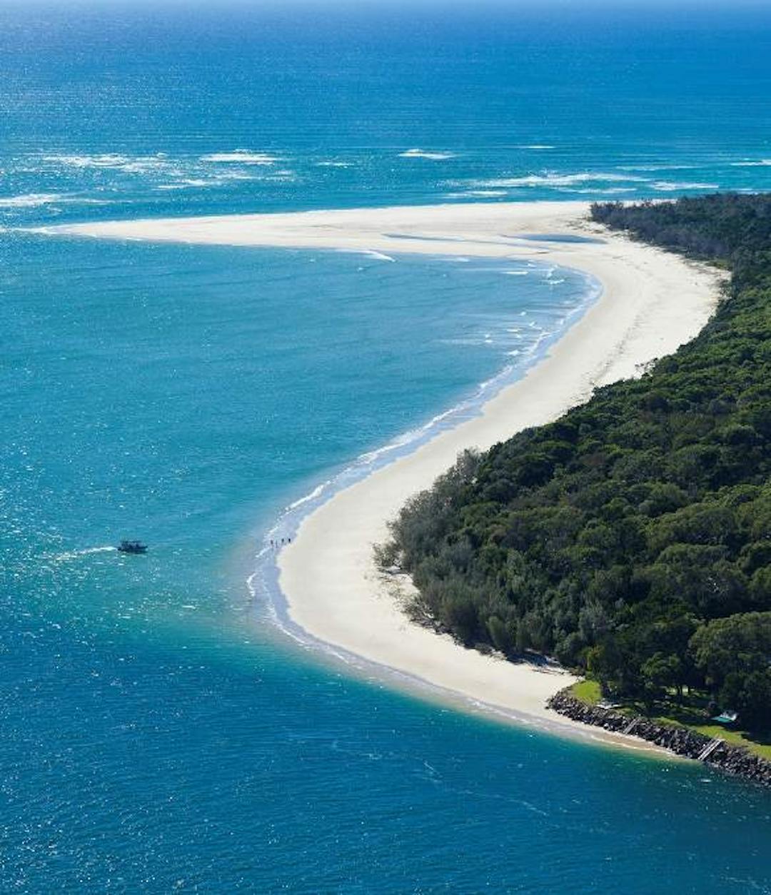
Amity Point (Pulan Pulan) is a small seaside locality on the north-western point of North Stradbroke Island (Minjerribah) situated off the coast of southeast Queensland.
Fronting the calm waters of Moreton Bay (Quandamooka), Amity Point is the perfect place to watch the sunset, admire the native plants and trees, and encounter a range of marine and island wildlife, including dolphins, turtles, whales, and koalas.
The Amity Point foreshore is at risk of long-term erosion due to episodic flow slide events and the southerly migration of the Rainbow Channel located between North Stradbroke Island and Moreton Island.
Amity Point has been declared an erosion-prone area under the Coastal Protection and Management Act 1995 and has a long history of significant erosion, which has resulted in the loss of Indigenous values, public and private land, and assets.
Redland City Council has worked with stakeholders, including Quandamooka Yoolooburrabee Aboriginal Corporation, State Government agencies, private landowners, and the project's Community Reference Group (CRG) to develop a plan known as a Shoreline Erosion Management Plan (SEMP).
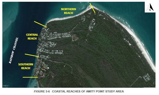
The Amity Point SEMP identifies erosion hotspots in the locality's three coastal reaches and recommends management actions for Council and private landowners to help manage and respond to current and future erosion risks.
What is the Community Reference Group?
The SEMP's CRG represents a cross-section of the Amity Point community and includes representatives from Quandamooka Yoolooburrabee Aboriginal Corporation. The CRG brings together Traditional Owners and local stakeholders to contribute their local knowledge of erosion, as well as the wider cultural, historical, environmental, and economic values of Amity Point towards the development of the SEMP.
The group has contributed by sharing information, insights, and progress reports back to their community networks.
Find out more
- Read the Amity Point SEMP and Implementation Plan located in the 'Documents' section
- Download project fact sheets located in the 'Fact Sheets' section
- Check out the latest project updates
- Learn about other similar projects, like the Coochiemudlo Island SEMP and the Coastal Hazard Adaptation Strategy in the 'Related Projects' section
-
Final draft Amity Point SEMP - Released to the public
Share Final draft Amity Point SEMP - Released to the public on Facebook Share Final draft Amity Point SEMP - Released to the public on X (formerly Twitter) Share Final draft Amity Point SEMP - Released to the public on Linkedin Email Final draft Amity Point SEMP - Released to the public linkConsultation has concluded
Yesterday Redland City Council released the Final Draft Amity Point Shoreline Erosion Management Plan (SEMP) for public information.
Comments and questions can be made directly to the website for two weeks, from today until 17 April 2019, through the ‘Comment on the SEMP’ tab.The final SEMP will then go forward for endorsement by Redland City Council, formalising the SEMP as a framework and strategy to manage and respond to the erosion impacting the vulnerable foreshore of Amity Point, North Stradbroke Island.
Council has worked closely with the Amity Point SEMP Community Reference Group (CRG), a representative body that has providedContinue reading
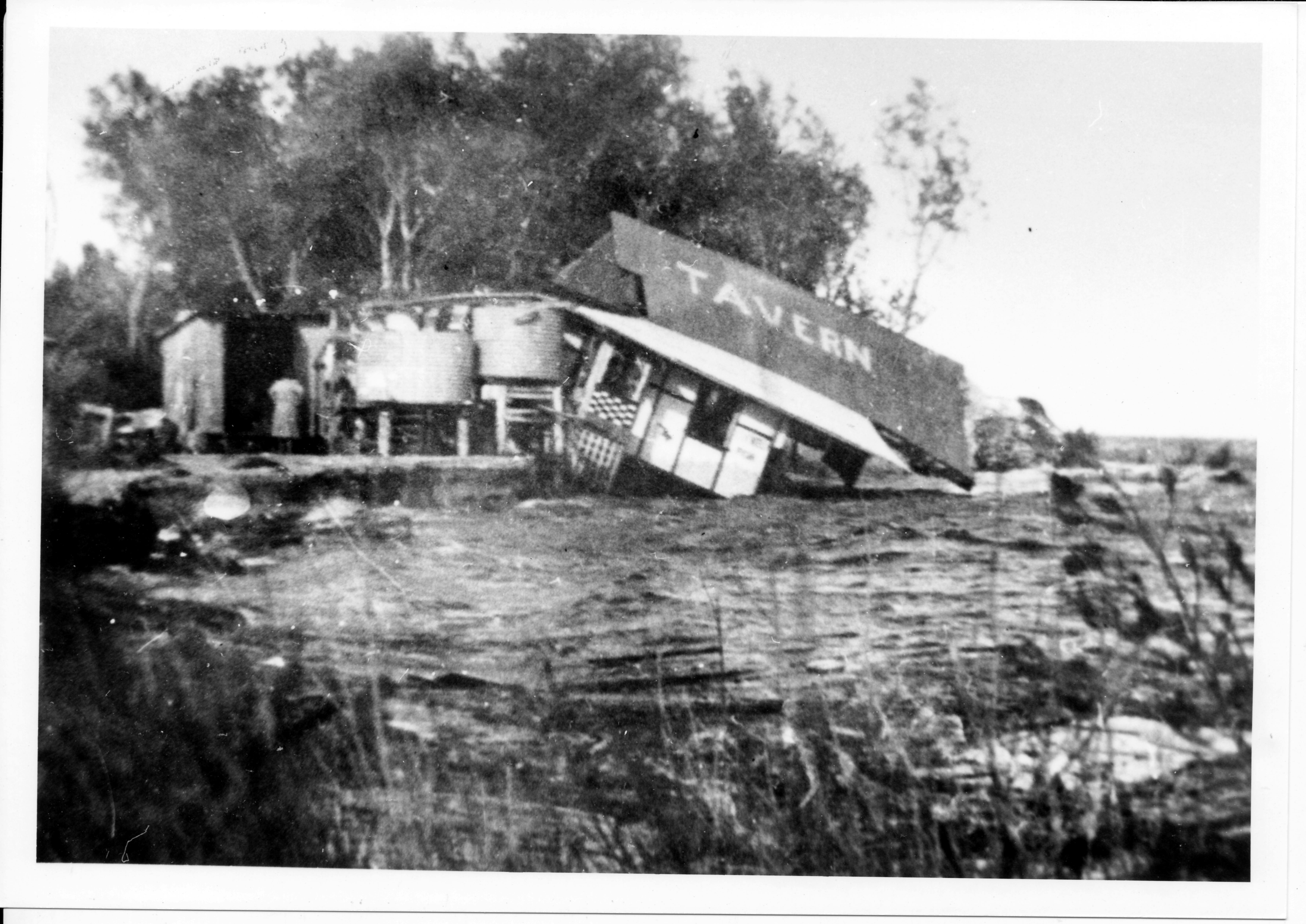
Erosion at Amity Point
Videos
-
 In January 2011 at Amity Point, a portion of the rock wall collapsed in front of the old school house. Video provided by Konrad Beinssen.


